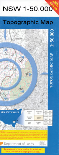
Mathoura 1-50,000 NSW Topographic Map
$16.95 – $31.95
Description:
Mathoura 7826s 1-50,000 scale NSW Topographical map is used for Walking, 4WD, Fishing, Camping, Motorcycle, both On and Off Road, Gold Prospecting and for those simply going for a family weekend drive.
Topographical maps show not only Contours of the Terrain but also Walking Tracks, Sealed and Unsealed Roads, Rivers, Creeks, Lakes, Historical Point of Interest, Old Mine Sites and National and State Park areas.
 We can Now LAMINATE and fold your map for $12.00. Just click on the image and add to the Trolley
NOW AVAILABLE PRINT ON DEMAND
Locations within this Map
Barmah Forest Pound Belleview Mathoura Angle Corner Tank Algeboia Plain Benarca Benarca Creek Benarca Railway Station Benarca Waterholes Big Circular Log Landing Black Gate Lagoon Black Fellows Creek Blackfellows Creek Boggy Creek Bore Corner Caldwells Waterhole Caloola Campbells Creek Catfish Lagoon Chimney Creek Coolamon Creek Cumbungie Swamp Edward River Regulator Freemans Camp Green Gully Gulpa Gulpa Cutting Horseshoe Bend Horseshoe Lagoon Caloona Tank Currys Crossing Deep Creek Horse Show Lagoon Kings Landing Kings Log Landing Kungamul Lemon Waterhole Little Edward Lagoon Little Edward River Long Swamp McCartners Creek Mars Mathoura Cemetery Mathoura Common Mathoura Ceneral Cemetery Mathoura Racecourse Mathoura Lagoon Mathoura Public School Mathoura Railway Station Town of Mathoura Melvilles Waterhole Moira Moira Creek Moira Lake Moira Marshes Moira National Forest Moira Railway Station Moira State Forest Moira Tank Village of Moira Mullowla Nallam Norris Bend O’Shanassys Creek O’Shanassys Cutting Perricoota Picnic Point St Helena Swamp Porters Creek Porters Creek Regulator Porters Plain Poverty Point Quandong Tank Racecourse Reserve Reed Beds Reed Beds Swamp Sheepwash Lagoon Sheldrakes Lake Shelldrakes Lake Shell Lagoon Shell Lake Stockyard Creek Swifts Creek Tamar The Green Gully Thyra Thyra Public School Thyra Railway Station Village of Thyra Tonis Bend Towna Turner Bend Wagtail Creek Warrick Creek Whites Swamp Wild Dog Creek Willow Bend Womboota Village of Womboota Village of Womboota East Womboota Dam Womboota Railway Station Womboota Tank Yarraman Yellow Waterhole Bullywarry or Mccartneys Creek Bunaloo East Public School Bunaloo Well Dora Creek Duck Lagoon Duffys Lagoon Duggans Lagoon Bunnaloo Bunnaloo Platform Bunnaloo Public School Bunnaloo Railway Station Village of Bunnaloo Bunnydigger Creek Bununka Moira Lakes Flora Reserve Circular Bend Mathoura Reservoir Harry Mccormick Arboretum Barmah Barmah Creek Barmah Lake Barmah Yards Broken Creek Budgee Creek Bullock Creek Bullocks Creek Cucumber Gully Cutting Creek Double Holes Goose Neck Goose Swamp Hut Lake Island Creek Island Lagoon Moira Lakes Mosquito Bend One Tree Crossing Pig Hole Pontoon Creek Rat castle Gully Rices Weir Top Island War Creek War Plain Welton Primary School Young Bend Plymouth Bunaloo Bunnaloo Well Manorbar Wild Duck Creek Yarraman Channel Deniboota Canal Womboota Station Woomboota Railway Station Caloola Tank
| Publisher: | New South Wales Government |
| Scale: | 1:50000 |
| Latitude Range: | 35° 45.0′ S – 36° 00.0′ S |
| Longitude Range: | 144° 30.0′ E – 145° 0.0′ E |
| Datum: |
GDA 9 4 |

