Monak 1-50,000 NSW Topographic Map
Price range: $16.95 through $31.95
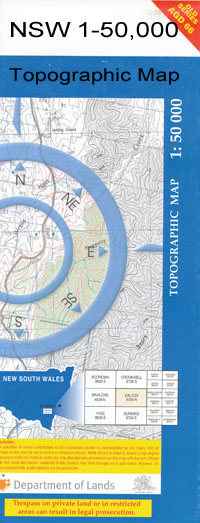
Description:
Monak 739s 1-50,000 scale NSW Topographical map is used for Walking, 4WD, Fishing, Camping, Motorcycle, both On and Off Road, Gold Prospecting and for those simply going for a family weekend drive.
Topographical maps show not only Contours of the Terrain but also Walking Tracks, Sealed and Unsealed Roads, Rivers, Creeks, Lakes, Historical Point of Interest, Old Mine Sites and National and State Park areas.
 We can Now LAMINATE and fold your map for $12.00. Just click on the image and add to the Trolley
NOW AVAILABLE PRINT ON DEMAND
Locations within this Map
Sunshine Farm Halcyon Pines Red Cliffs Big Tree Bend Boorong Bend Gol Gol State Forest Mcfarlanes Reef Mail Change Creek Mallee Cliffs Mallee Cliffs State Forest Mandock Creek Mindook Creek Monak Moutrier Creek Paringi Police Bend Sandbar Bend Snaggy Point Than Dhan Bend Devils Racecourse Buxton Bend Buxtons Bend Bengallow Creek Bengallow Dean Blackfellows Branch Channel Bonnie Doon Bend Bonnongee Winery Bottle Bend Bullock Swamp Cadjill Tank Callaghan Plain Cardross Primary School Carwarp Carwarp Fire Station Carwarp Primary School Carwarp Telephone Exchange Carwarp West Echo Point Ginquam High Lift Branch Inlet Creek Iraak Causeway Irymple South Primary School Karadoc Karadoc Bend Karadoc Swamp Keillors Branch Koorlong Koorlong Primary School Lake Iraak Lambert Island Linderman Winery Main Eastern Channel Main Western Channel Mildura-Yelta Railway Nangiloc Primary School Nangiloc Fire Station Nangiloc Public Hall No. 1 Channel Red Cliffs Central Primary School Red Cliffs East Primary School Red Cliffs Fire Station Red Cliffs Hospital Red Cliffs Magistrates Court Red Cliffs Police Station Red Cliffs Post Office Red Cliffs Primary School Red Cliffs Secondary College Red Cliffs Telephone Exchange Robinson Tank South West Public Hall Stewart Primary School Sunnycliffs Primary School Thurla Towrie Creek Trelloars Branch Woodbine Park Yatpool Yatpool Channel Billabong Cardross Benetook Iraak Lake Iraak Nangiloc
| Publisher: | New South Wales Government |
| Scale: | 1:50000 |
| Latitude Range: | 34° 15.0′ S – 34° 30.0′ S |
| Longitude Range: | 142° 0.0′ E – 142° 30.0′ E |
| Datum: | GDA 94 |