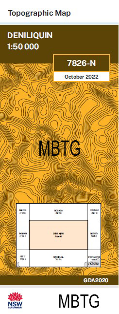
Deniliquin 1-50,000 NSW Topographic Map
Price range: $16.95 through $28.95
Description:
Deniliquin 7827n 1-50,000 scale NSW Topographical map is used for Walking, 4WD, Fishing, Camping, Motorcycle, both On and Off Road, Gold Prospecting and for those simply going for a family weekend drive.
Topographical maps show not only Contours of the Terrain but also Walking Tracks, Sealed and Unsealed Roads, Rivers, Creeks, Lakes, Historical Point of Interest, Old Mine Sites MBTG and National and State Park areas.
NOW AVAILABLE PRINT ON DEMAND
Locations within this Map
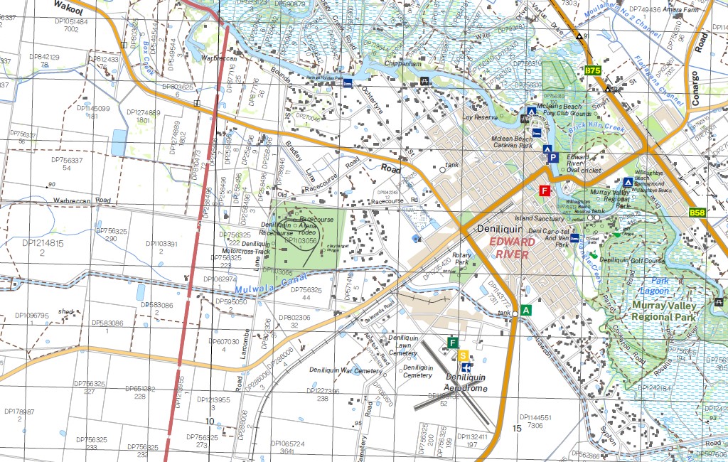
Deniliquin Aljoes Creek Aljoes Syphon Box Creek Boyeo Brassi Brick Kiln Creek Brown Park Cadell Tilt Caldwell Caldwell Channel Caldwell Railway Station Citgathen Coonambidgal Creek Cudoc Deniboota Canal Deniliquin Aerodrome Deniliquin High School Deniliquin Post Office Deniliquin South Public School Deniliquin Railway Station Deniliquin State Forest Deniliquin Technical College Deniliquin War Cemetery Derrulaman Creek Edward Public School Edward River Sportsground Four Post Creek Gobram Gotha Gothog Gulpa Gulpa Creek Gulpa Island Gulpa Island National Forest Gulpa Island State Forest Hill Plain Hynes Park Village of Caldwell Coonabigal Creek Deep Creek Deniliquin South Deniliquin West Public School Gulpa Railway Siding Hill Plain Railway Siding Hynee Park J.P. Burchfield Junior Park Jubilee Park Lagoon Reserve Mcfaull Park Mcleans Beach Mcpaull Park Memorial Park Millewa National Forest Millewa State Forest Mill Post Creek Moon Swamp Napier Public School Napier Street Public School Park Lagoon Perrin Park Polygonum Swamp Purdanima South Deniliquin Town of South Deniliquin Southdown Southdown Railway Platform Swan Lagoon Tantonan Tantonan Railway Station Tarangle Tarangle Creek Taylors Crossing Wakool River Walliston Warbreccan MBTG Waring Gardens Windeyer Park Wirringan Wongal Yalama Village of Yalama Yalama Public School Yallakool Channel Yaloke Bunnaloo Channel Burchfield Park Yallakool State Forest Deniliquin Reservoir Bullatale Flora Reserve Edward River Tuppal Creek Whittier Park Bullatale Creek Murray Shire Allendale
| Publisher: | New South Wales Government |
| Scale: | 1:50000 |
| Latitude Range: | 35° 30.0′ S – 35° 45.0′ S |
| Longitude Range: | 144° 30.0′ E – 145° 0.0′ E |
| Datum: | GDA 2020 |
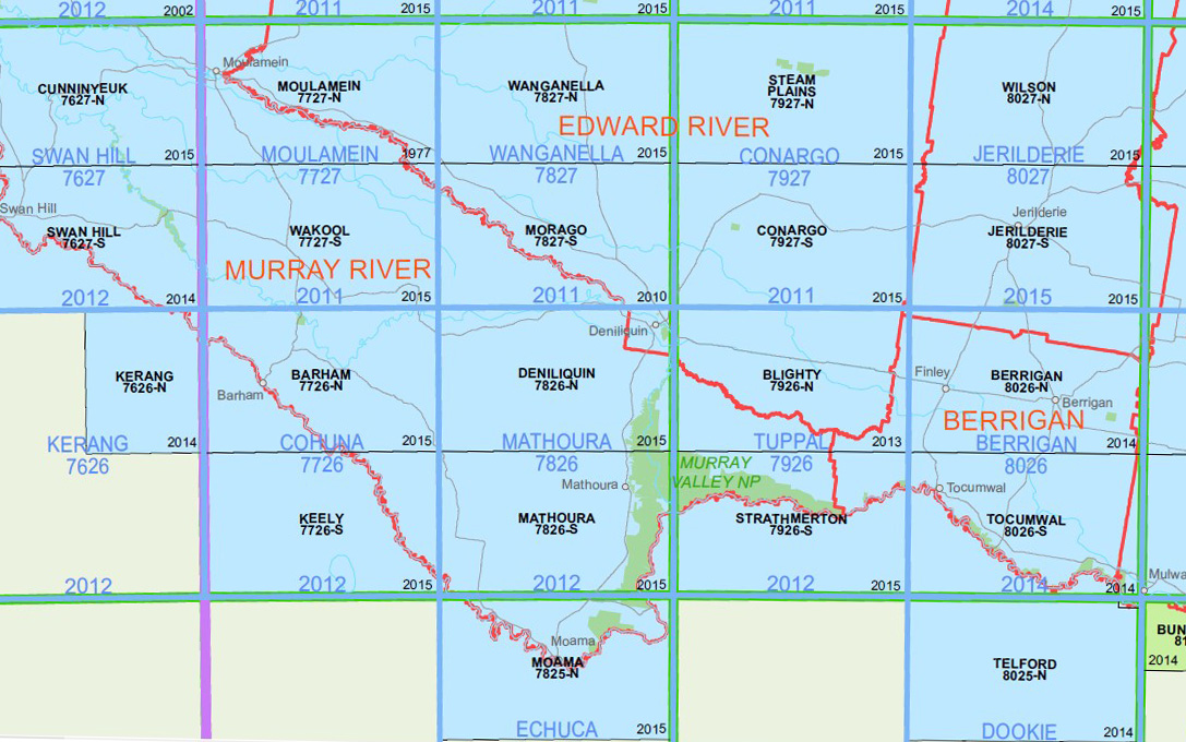
You may also like…
-
Wakool 1-50,000 NSW Topographic Map
Price range: $16.95 through $28.95Select options This product has multiple variants. The options may be chosen on the product page -
Moulamein 1-50,000 NSW Topographic Map
Price range: $16.95 through $28.95Select options This product has multiple variants. The options may be chosen on the product page -
Morago 1-50,000 NSW Topographic Map
Price range: $16.95 through $28.95Select options This product has multiple variants. The options may be chosen on the product page -
Deniliquin 1-250,000 Topographic Map
Price range: $15.95 through $27.95Select options This product has multiple variants. The options may be chosen on the product page