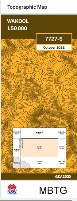
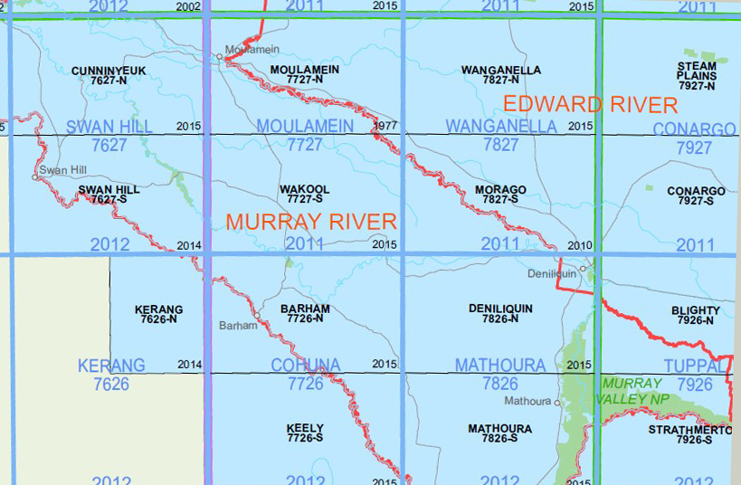
Wakool 1-50,000 NSW Topographic Map
Price range: $16.95 through $28.95
Description:
Wakool 7727S 1-50,000 scale NSW Topographical map Now Print on Demand is used for Walking, 4WD, Fishing, Camping, Motorcycle, both On and Off Road, Gold Prospecting and for those simply going for a family weekend drive.
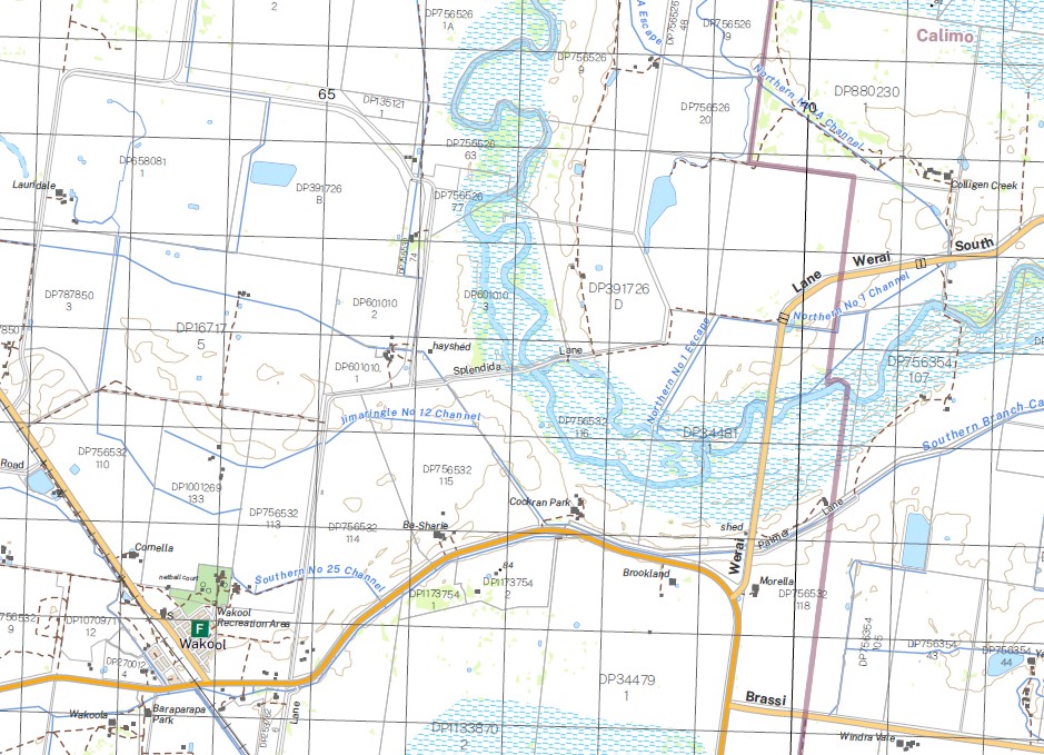
Topographical maps show not only Contours of the Terrain but also Walking Tracks, Sealed and Unsealed Roads, Rivers, Creeks, Lakes, Historical Point of Interest, Old Mine Sites and National and State Park areas.
NOW AVAILABLE PRINT ON DEMAND
Locations within this Map
Wakool Belmore Beremegad Beremegad Tank Bookit Box Creek Branch Creek Chowar Christies Creek Cobwell Cockran Gonn Gynong Jimaringle Jimaringle Branch Canal Jimaringle Creek Village of Jimaringle Little Merran Creek Merran Creek Middle Creek Middle Creek Water Course Nearroongaroo Niemur Drain Niemur Main Drain Noorong Creek Reed Bed Creek Shaws Creek Simpsons Creek Taylors Creek Toolon Tullakool Tullakool Canal Tullakool Channel Village of Tullakook Wakool Public School Wakool Railway Station Village of Wakool Wandaradget Whymoul State Forest Yadabal Yadabal Lagoon Bundarra Creek Bunna Creek Burraboi Village of Burraboi Burragorrima Creek Noorong Niemur Cochrans Creek Cockran Creek Jawbone Creek Grassmere Rangemore Burrabol Gwynnes Creek Gambrie Barbers Creek North Wakool
| Name: | Wakool |
| Publisher: | New South Wales Government |
| Scale: | 1:50000 |
| Latitude Range: | 35° 15.0′ S – 35° 30.0′ S |
| Longitude Range: | 144° 0.0′ E – 144° 30.0′ E |
| GDA 2020 |
You may also like…
-
Morago 1-50,000 NSW Topographic Map
Price range: $16.95 through $28.95Select options This product has multiple variants. The options may be chosen on the product page -
Moulamein 1-50,000 NSW Topographic Map
Price range: $16.95 through $28.95Select options This product has multiple variants. The options may be chosen on the product page -
Deniliquin 1-50,000 NSW Topographic Map
Price range: $16.95 through $28.95Select options This product has multiple variants. The options may be chosen on the product page -
Deniliquin 1-250,000 Topographic Map
Price range: $15.95 through $27.95Select options This product has multiple variants. The options may be chosen on the product page