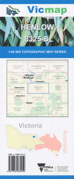
Henlow 1-50,000 Vicmap
Price range: $12.00 through $24.00
Description:
Henlow 1-50,000 scale Vicmap Topographical map 8325S is used for Walking, 4WD, Fishing, Camping, Motorcycle, both On and Off Road, Gold Prospecting and for those simply going for a family weekend drive.
Topographical maps show not only Contours of the Terrain but Walking Tracks, Sealed and Unsealed Roads, Rivers, Creeks, Lakes, Historical Point of Interest, Old Mine Sites mbtg and National and State Park areas.
Main Features of this map include:
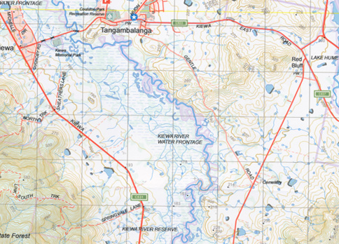
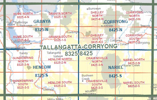
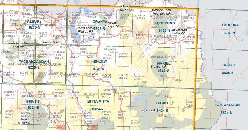
Eskdale, Tallandoon, Fernvale, Kiewa townships, bottom edge of Lake Hume, Mitta Mitta River, Gundowring, Dederang Caravan Park, Mitta Mitta River, Tallangatta, Lochart Creek, Bullioh Plantation, Yabba, Wyeebo, NOORONGONG BR, Bullhead Creek, Tallangatta South, Fairyknowe, WAGRA BR, Snowy River Camp, mbtg, Tallangatta Valley, TALLANGATTA Creek, Bullioh Plantation, Henlow, Eskdale, Tallangatta South, NOORONGONG BR, Mitta Mitta River, Katie Peters Reserve, Mitta Mitta Reference Area (no public access), Bullhead Plantation, Banimboola Creek Natural Catchment Area
Keiwa, Tangambalanga, Sandy Creek Recreation Reserve, Mitta Mitta River, Charleroi, Fernvale, Noorongong, Kergunyah, Lockhart Gap, Hellhole Creek,, Dederang, Tallandoon, Gundowring, mbtg, Kergunyah South, Upper Gundowring, Gundowring Streamside Reserve (Kiewa River K23), Wild Horse Hill, Steele Spur, Eskdale, mbtg, Mitta Mitta River
You may also like…
-
GUNDOWRING NORTH 1-25,000 Vicmap Topo 8325-3-N
Price range: $14.00 through $26.00Select options This product has multiple variants. The options may be chosen on the product page -
Tallangatta 1-250,000 Topographic Map
Price range: $15.95 through $27.95Select options This product has multiple variants. The options may be chosen on the product page -
HENLOW SOUTH 1-25,000 Vicmap Topo Map 8325-2-S
Price range: $14.00 through $26.00Select options This product has multiple variants. The options may be chosen on the product page -
Yackandandah 1-50,000 Vicmap
Price range: $12.00 through $24.00Select options This product has multiple variants. The options may be chosen on the product page -
Granya 1-50,000 Vicmap Topographic Map 8325-N
Price range: $12.00 through $24.00Select options This product has multiple variants. The options may be chosen on the product page -
Corryong 1-50,000 Vicmap Topographical Map 8425-N
Price range: $14.00 through $26.00Select options This product has multiple variants. The options may be chosen on the product page -
Nariel 1-50,000 Vicmap
Price range: $12.00 through $24.00Select options This product has multiple variants. The options may be chosen on the product page -
Bright 1-50,000 Vicmap
Price range: $12.00 through $24.00Select options This product has multiple variants. The options may be chosen on the product page -
Mitta Mitta 1-50,000 Vicmap
Price range: $12.00 through $24.00Select options This product has multiple variants. The options may be chosen on the product page -
Albury 1-50,000 Vicmap
Price range: $12.00 through $24.00Select options This product has multiple variants. The options may be chosen on the product page