
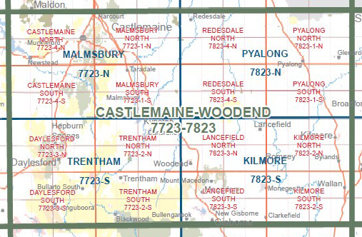
LANCEFIELD NORTH 1-25,000 Vicmap Topo 7823-3-N
Price range: $14.00 through $26.00
Description:
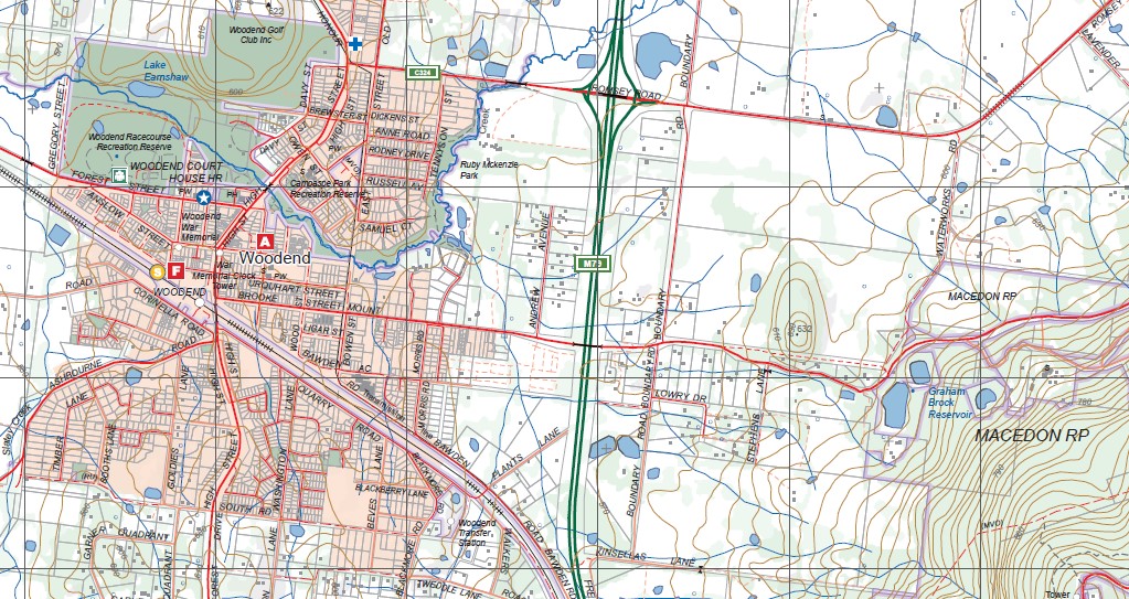
LANCEFIELD NORTH 1-25,000 Vicmap Topographic Map 78233N Now Print On Demand is used for Walking, 4WD, Fishing, Camping, Motorcycle, both On and Off Road, Gold Prospecting and for those simply going for a family weekend drive.
This is a new series of 1-25,000 scale maps, all of Victoria is now covered by these maps, including maps over the South Australian and NSW Borders.
Topographical maps show not only Contours of the Terrain but Walking Tracks, Sealed and Unsealed Roads, Rivers, Creeks, Lakes, Historical Points of Interest, Old Mine Sites mbtg and National and State Park areas.
Main Features of this map includes:
Covers the old series 1-25,000 Vicmaps Woodend and Romsey
Woodend, Romsey, Lancefield, MOUNT DIOGENES, Hanging Rock, Carlsruhe, Cadello, MACEDON Regional Park, THE JIM JIM, Cobaw, Cobaw State Forest, Newham, CAMELS HUMP, TUNNEL CREEK NFR, Hesket, Lancefield Number One and two Reservoir, Rochford, BROCK MONUMENT, Romsey Reservoir, OCHILTREE HILL, Musteys Bridge
You may also like…
-
Castlemaine Woodend 1-100,000 Vicmap 7723 7823
Price range: $12.00 through $24.00Select options This product has multiple variants. The options may be chosen on the product page -
LANCEFIELD SOUTH 1-25,000 Vicmap Topo 7823-3-S
Price range: $14.00 through $26.00Select options This product has multiple variants. The options may be chosen on the product page -
Kilmore 1-50,000 Vicmap Topographic Map 7824-S
Price range: $14.00 through $26.00Select options This product has multiple variants. The options may be chosen on the product page -
Wombat State Forest 4WD Map Meridian Edition 5
Price range: $14.95 through $26.96Select options This product has multiple variants. The options may be chosen on the product page