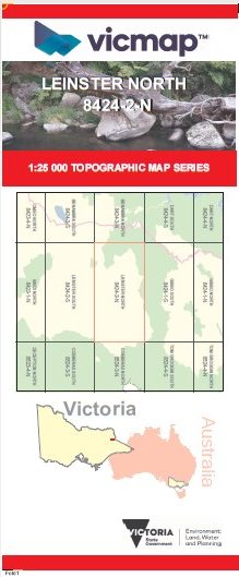
LEINSTER NORTH 1-25,000 Vicmap Topo Map 8424-2-N
Price range: $14.00 through $26.00
Description:
LEINSTER NORTH 1-25,000 Vicmap Topographic Map 84242N Now Print On Demand is used for Walking, 4WD, Fishing, Camping, Motorcycle, both On and Off Road, Gold Prospecting and for those simply going for a family weekend drive.
This is a new series of 1-25,000 scale maps, all of Victoria is now covered by these maps, including maps over the South Australian and NSW Borders.
Topographical maps show not only Contours of the Terrain but Walking Tracks, Sealed and Unsealed Roads, Rivers, Creeks, Lakes, Historical Points of Interest, Old Mine Sites mbtg and National and State Park areas.
Also now available printed on Plastic Waterproof Paper Folded
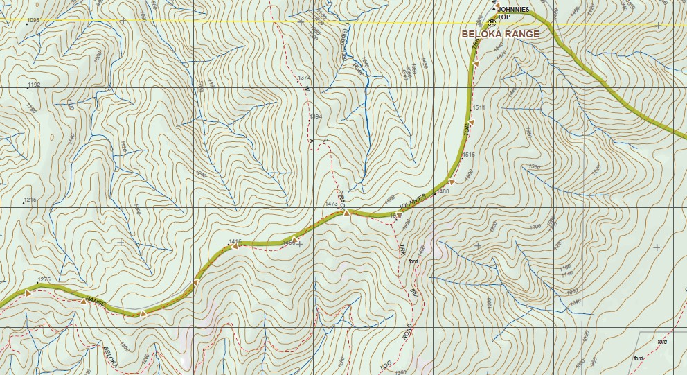
Main Features of this map includes:
Part of the Australian Alpine Walking Track
MACFARLANE LOOKOUT NFSR, Uplands State Forest, mbtg Benambra State Forest, Pendergast Lookout, Beloka Range, JOHNNIES TOP, Mount Misery, Mount PENDERGAST, THE LADDER
You may also like…
-
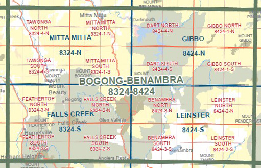
BOGONG BENAMBRA 1-100,000 Vicmap 8324-8424
Price range: $14.00 through $26.00Select options This product has multiple variants. The options may be chosen on the product page -
Leinster 1-50,000 Vicmap
Price range: $12.00 through $24.00Select options This product has multiple variants. The options may be chosen on the product page -
LEINSTER SOUTH 1-25,000 Vicmap Topo Map 8424-2-S
Price range: $14.00 through $26.00Select options This product has multiple variants. The options may be chosen on the product page -
Gibbo 1-50,000 Vicmap
Price range: $12.00 through $24.00Select options This product has multiple variants. The options may be chosen on the product page