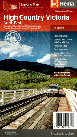
High Country Victoria North East Map Hema
$15.95
18 in stock
Description:
The Victorian High Country – North Eastern Map (1st edition)
This map is part of Hema’s new Victorian High Country Map Series and covers the Northern Borderlands Area from Omeo to Jindabyne. Printed on durable waterproof paper, this map features Hema’s iconic mapping and extensive points of interest. Featuring roads and 4WD tracks field-checked by the Hema Map Patrol for superior accuracy.
It combines Hema’s entire database of roads and 4WD tracks with touring points of interest and topographic information. Also included are seasonal track closures, camping areas, old townsites, huts, accommodation and distances.
Key Features
- 4WD tracks
- Huts
- Camping areas
- Old townsites
- Seasonal track closures
- Road distances
- Accommodation
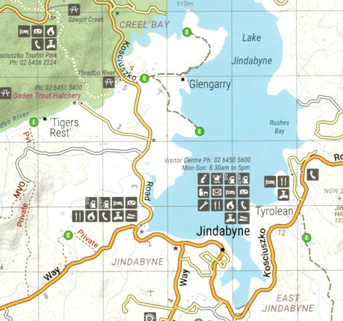
Thowgla Upper Tallangatta Valley Mitta Mitta Anglers Rest Omeo Tom Groggin Tom Groggin State Park Lake Dartmouth Benambra Lake Jindabyne Jindabyne Mt Willis Thedbo Village Seldom Seen
Key Specifications
Edition: 1st
Publication Date: 15/10/20
Scale: 1:100,000
Folded size (WxHxD): 140mm x 250mm x 3mm
Flat size (WxH): 700mm x 1000mm
Weight: 0.09kgs
ISBN 9321438001737
Covers the following Vicmap 1-50,000 scale maps:-
Nariel, Geehi, Gibbo, Tom Groggin, Leinster, Willis, Bindi, Deddick