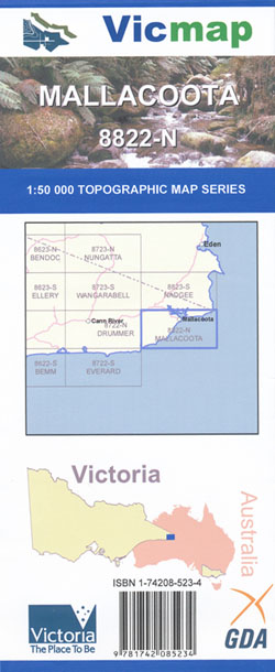
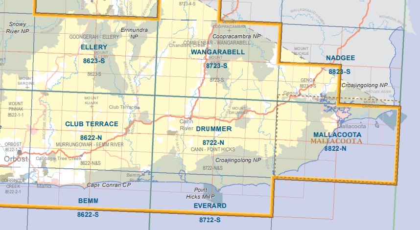
Mallacoota 1-50,000 Vicmap Topographic Map 8822-N
Price range: $14.00 through $26.00
Description:
Part of the Wilderness Coast Walk
Mallacoota 1-50,000 scale Victorian Topographical map 8822N is used for Walking, 4WD, Fishing, Camping, Motorcycle, both On and Off Road, Gold Prospecting and for those simply going for a family weekend drive.
Topographical maps show not only Contours of the Terrain but Walking Tracks, Sealed and Unsealed Roads, Rivers, Creeks, Lakes, Historical Point of Interest, Old Mine Sites mbtg and both National and State Park areas.
Main Features of this map includes:
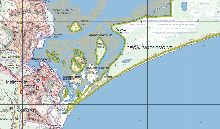
Mallacoota Inlet
From the Victorian NSW Border to Wingan Inlet
Part of Croajingolong National Park and Wilderness Coast
Gabo Island
Mallacoota, Mallacoota State Forest, Gabo Island, Top Lake, Mallacoota Inlet, Allan Head, Tullaberga Island, Lake Barracoota, Cape Howe Wilderness Zone, Howe Hill, Howe Range, Lake Wau Wauka, Victoria and NSW Border at Cape Howe, Western half of Mallacoota, Mallacoota State Forest, Drummer State Forest, Hard To Seek Creek, Wingan State Forest, Genoa Peak and Genoa Peak Walking Track, Sandpatch Wilderness Zone, East Gippsland Coastal streams Natural Catchment Area, Benedore River Reference Area (no public access), mbtg, Double Creek Natural Catchment Area, Pepper Clay Point, Wingan Inlet, Wingan Inlet Camping Ground, Wingan River, Wingan State Forest, East Gippsland Coastal streams Natural Catchment Area, Sandpatch Wilderness Zone, Benedore River Reference Area (no public access), Little Rame Head, Seal Creek Reference Area (no public access), Shipwreck Creek
ISBN 9781742085234
You may also like…
-
MALLACOOTA NORTH 1-25,000 Vicmap Topo Map 8822-1-N
Price range: $14.00 through $26.00Select options This product has multiple variants. The options may be chosen on the product page -
Nadgee 1-50,000 Vicmap Topographic Map 8823-S
Price range: $14.00 through $26.00Select options This product has multiple variants. The options may be chosen on the product page -
NADGEE SOUTH 1-25,000 Vicmap Topo Map 8823-2-S
Price range: $14.00 through $26.00Select options This product has multiple variants. The options may be chosen on the product page -
Everard 1-50,000 Vicmap
Price range: $12.00 through $24.00Select options This product has multiple variants. The options may be chosen on the product page -
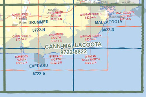
CANN MALLACOOTA 1-100,000 Vicmap 8722-8822
Price range: $14.00 through $26.00Select options This product has multiple variants. The options may be chosen on the product page