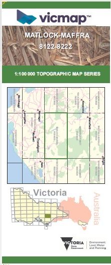
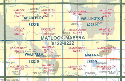
MATLOCK MAFFRA 1-100,000 Vicmap Topo 8122-8222
$14.00
Description:
MATLOCK MAFFRA 1-100,000 Vicmap 8122-8222 NOW PRINT ON DEMAND is used for Walking, 4WD, Fishing, Camping, Motorcycle, both On and Off Road, Gold Prospecting and for those simply going for a family weekend drive.
This is a new series of 1-100,000 scale maps, all of Victoria is covered by these maps.
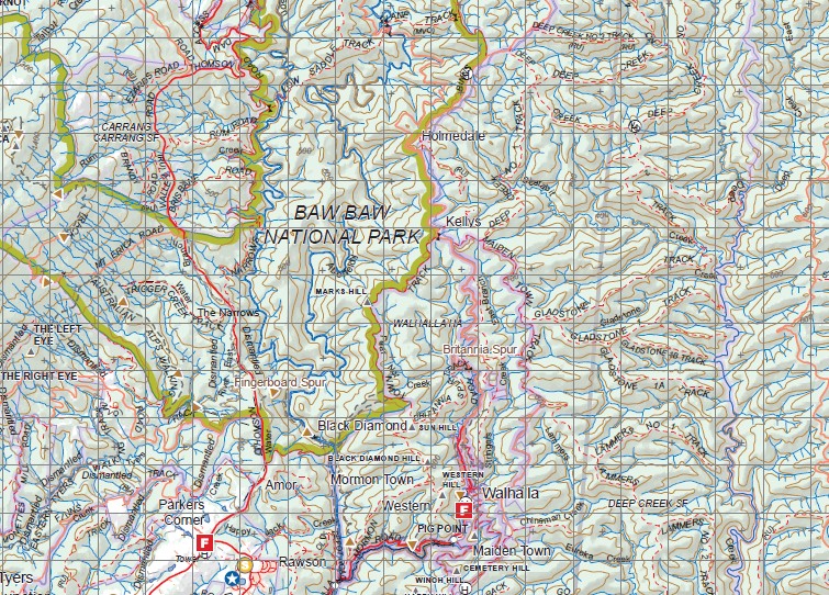
Topographical maps show not only Contours of the Terrain but Walking Tracks, Sealed and Unsealed Roads, Rivers, Creeks, Lakes, Historical Points of Interest, Old Mine Sites and National and State Park areas.
Main Features of this map includes:
Walhalla, Erica, Mount Baw Baw, Woods Point, MOUNT GREGORY, Toorongo, Noojee, Neerim North, Fumina, Mount Tyers, Tanjil Bren, Mount Easton, Woods Point Thompson Dam, Matlock A1 Mine Settlement, Burnt Camp, MOUNT SHILLINGLAW, Mount Singleton Mount Selma, Mount Victor, Blue Jacket, Aberfeldy, THE PINNACLE, MOUNT KERNOT, Beardmore, MOUNT SAINT GWINEAR, Mount Tyers, Tyers Junction, Britannia Spur, Store Point, Toombon, Mount Useful, Licola, Seaton, Heyfield, Cowwarr, Glenmaggie, Lake Glenmaggie, Mount Margaret, Avon Wilderness, Spion Kopje, Mount Wellington, Maffra
You may also like…
-
Jamieson Licola Adventure Map Rooftop
Price range: $11.95 through $25.00Select options This product has multiple variants. The options may be chosen on the product page -
Aberfeldy 1-50,000 Vicmap
Price range: $12.00 through $24.00Select options This product has multiple variants. The options may be chosen on the product page -
Maffra 1-50,000 Vicmap
Price range: $12.00 through $24.00Select options This product has multiple variants. The options may be chosen on the product page -
Walhalla Woods Point Adventure Map Rooftop
Price range: $12.95 through $25.00Select options This product has multiple variants. The options may be chosen on the product page -
Wellington 1-50,000 Vicmap
Price range: $12.00 through $24.00Select options This product has multiple variants. The options may be chosen on the product page -
Walhalla 1-50,000 Vicmap Topo Map 8122-S
Price range: $12.00 through $24.00Select options This product has multiple variants. The options may be chosen on the product page