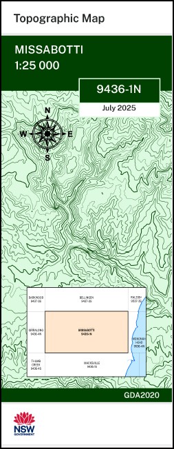

Missabotti 1-25,000 NSW Topographic Map 9436-1-N
Price range: $16.95 through $28.95
Description:
Missabotti 1-25,000 NSW Topographic Map 9436-1-N
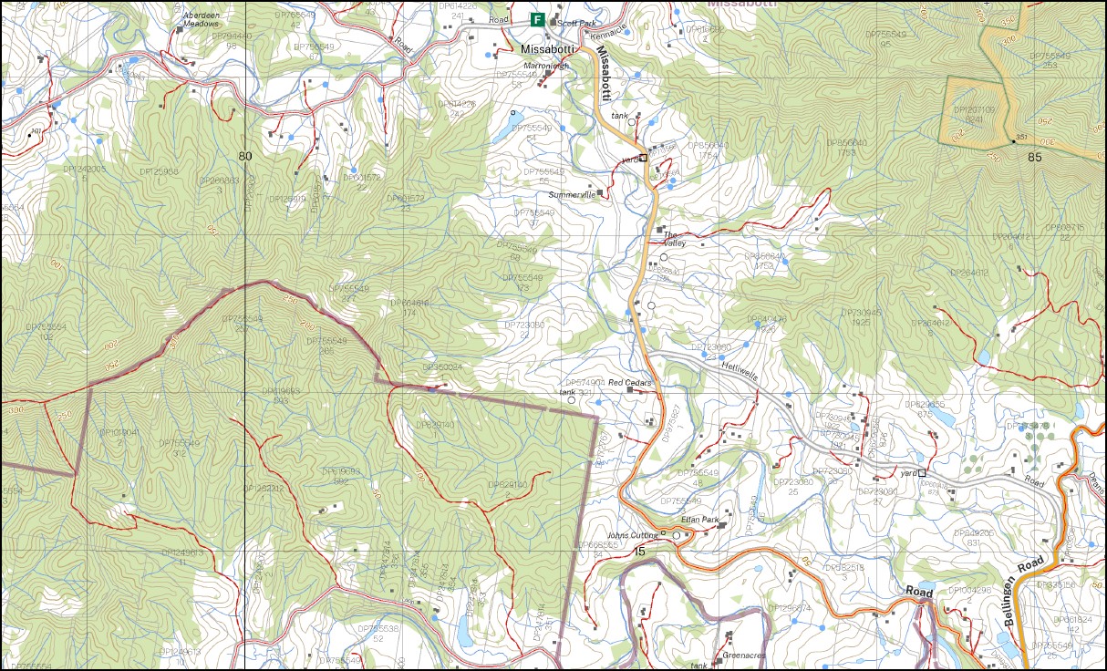
Ponderosa Pickett Hill Benbowra Bollanolla Mountain Bowra Mountain Bowra River Bryce Island Bryces Knob Buchanans Creek Buckra Bendinni Cow Creek Deep Creek Dyers Hill Edwards Knob Mount England Gladstone Mount Gladstone Hogans Creek Kalang Kennaicle Creek Deep Creek North Beach mbtg Kennacle Creek Lumby Hill Middle Kalang Missabotti Missabotti Creek Moran Brothers Nambucca River Newry National Forest Newry State Forest North Branch North Creek Peterkins School Platform Peterkins Siding Picket Picket Hill Picket Hill Creek Raleigh Spicketts Creek Sullivans Creek Tarkeeth Upper Missabotti Valla Valla Beach Public School Valley Valley Viewmont Viewmont Creek Viewmont Public School Viewmont Mountain Viewmont State Forest Dyers Mountain Nunguu Mirral Aboriginal Area Brierfield Valla Siding
| Name: | Missabotti |
| Publisher: | New South Wales Government |
| Scale: | 1:25,000 |
| Latitude Range: | 30° 30.0′ S – 30° 37.5′ S |
| Longitude Range: | 152° 45.0′ E – 153° 0.0′ E |
| Datum: | GDA 2020
Edition 2025 |
| Approx Print Size: | 0.56m X 1.11m |
You may also like…
-
Bellingen 1-25,000 NSW Topographic Map 9437-2-S
Price range: $16.95 through $28.95Select options This product has multiple variants. The options may be chosen on the product page -
Hornsby 1-25,000 NSW Topographic Map 9130-4-S
Price range: $16.95 through $28.95Select options This product has multiple variants. The options may be chosen on the product page -
Girralong 1-25,000 NSW Topographic Map
Price range: $16.95 through $31.95Select options This product has multiple variants. The options may be chosen on the product page -
Raleigh 1-25,000 NSW Topographic Map 9537-3-S
Price range: $16.95 through $28.95Select options This product has multiple variants. The options may be chosen on the product page -
Bellbrook 1-25,000 NSW Topographic Map 9436-3-N
Price range: $16.95 through $28.95Select options This product has multiple variants. The options may be chosen on the product page