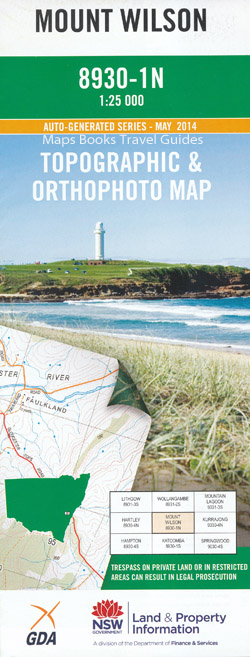
Mount Wilson 1-25,000 NSW Topographic Map
$16.95
Description:
8930-1-N
This map includes the following localities: Lindfield Park Burramoko Ridge Mount Victoria Asgard Brook Asgard Head Anvil Ridge Anvil Rock Asgard Swamp Bald Head Bald Head Ridge Bald Hills Gully Baltzer Lookout Mount Banks Banks Gully Banks Ridge Banks Wall Mount Barranbali Mount Bell Bell Bell Public School Bell Railway Station Bennett Gully Bennett Lookout Berambing Gully Berambing Picnic Area Berambing Ridge Bluff Head Bluff Head Ravine Blue Mountains National Park Blue Gum Forest Blackheath Walls Blackheath Plateau Blackheath Creek Blackheath Aerodrome Blackheath Cemetery Birrabang Brook Birrabang Ridge Birrabang Walls Boorong Crags Boorong Gully Boyce Boyce Gully Mount Boyce Calcutta Falls Mount Caley Camels Hump Camels Saddle Carmarthen Brook Carmarthen Ridge Charles Mount Charles Clarke Head Claustral Brook Coxs Cave Crayfish Creek Cripps Lookout Dallang Rill Dalpura Creek Dalpura Head Dalpura Ridge Dargans Creek David Crevasse Edgeworth David Head Engineers Cascade Explorers Brook Explorers Range Explorers Wall Fairy Bower Creek Fairy Bower Fairy Dell Creek Fenris Gully Flagstaff Hill Frank Hurley Head Gadara Creek Gadara Ridge Gaping Gill George Phillip Lookout Ghost Hill Girraween Cave Glow Worm Cave Grose Gorge Hartley Pass Hat Hat Hill Hat Hill Creek Mount Hay Mount Haystack Haystack Ridge Mount Hay Wall Hordern Gully Hornes Point Hungerfords Gully Ikara Head Irvine Jinki Gully Jinki Ridge Jungaburra Brook Kamarah Bluffs Kamarah Gully Kamarah Ridge Kangaroo Corner Creek Kerosene Creek Fern Tree Hill Hartley Vale Railway Station Horne Point King George King George Brook Mount King George Kolonga Mountain Kolonga Ridge Koombanda Brook Koombanda Ridge Lightning Ridge Little Zig Zag Liversidge Hill Mill Creek Mistake Ravine Moogan Gully Mount Hay Range Mount Piddington Lookout Mount Victoria Post Office Mount Victoria Public School Mount Victoria Railway Station Mount Wilson Mount Wilson Public School North Tomah Spur Nungaroo Creek Nungaroo Ridge Odin Gully Odin Head One Tree Hill Orang Utan Gully Orang Utan Pass Oronga Gully Oronga Ridge Perrys Lookdown Piddington Mount Piddington Pierces Creek Pierces Pass Pierces Ravine Pulpit Rock Pulpit Rock Lookout Rainbow Ravine Range Creek Range Hill Range Hill Creek Ranon Brook Rhododendron Garden Rienits Pass Rigby Hill Ross Cave Round Hill Gully Saddle Hill Shaw Gully Stockyard Creek Stockyard Gully Mount Strzelecki Sunset Rock Surveyors Creek Table Hill Tallara Bluff Tallara Creek Tallara Ridge Thor Head Thunder Gorge Tomah Tomah Bluffs Tomah Creek Mount Tomah Tomah South Tomah Spur Valhalla Head Victoria Victoria Brook Victoria Creek Victoria Falls Lookout Victoria Falls Victoria Falls Creek Walford Gully Walls Lookout Warawaralong Waterfall Creek Watertrough Hill Westerway Falls Wilkinson Hill Mount Wilkinson Wilson Wongarra Gully Wongarra Hill Wynnes Rocks Lookout Wynnes Rocks Yerra Crags Yileen Gully Yileen Spur Zobel Gully Dismal Dingle Mount Dixon Docker Buttress Docker Head Du Faur Buttress Du Faur Head Du Faurs Rocks Burra Korain Head Burra Korain Ridge Burramoko Head Burramoko Hill Mount Tomah Botanic Garden Darling Causeway Hourn Point Hay Venus Tor Berambing Blue Montains National Park Barkala Falls Chain Peak
| Scale: | 1:25000 |
| Latitude Range: | 33 30.0 S – 33 37.5 S |
| Longitude Range: | 150 15.0 E – 150 30.0 E |
| Approx Print Size: | 0.56m X 1.11m |
| Projection: | Transverse Mercator |


