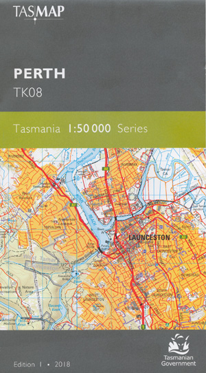
Perth 1-50,000 Tasmap Topographic Map
$13.95
1 in stock
Description:
Perth 1-50,000 Tasmap Topographic Map
Locations within this Map
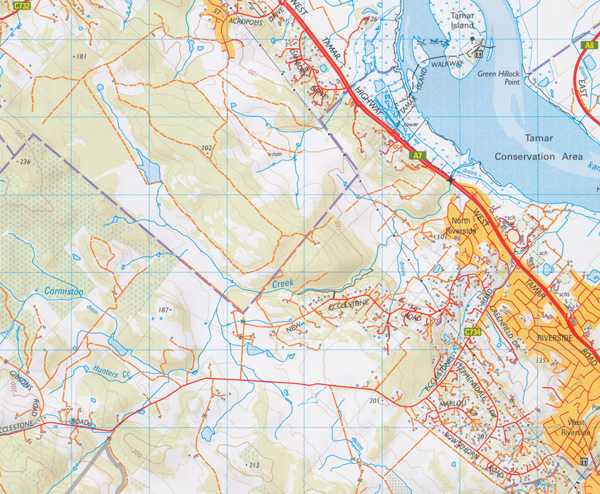
Russells Plains Mt Stewart Corners The Ecclestone House Alanvale Glen Ayr Woodlands Dunedin Illaro Franklin House Aplico Elverton Meander Rise Entally Craigwood Strathroy Marchington Mt Oriel Briarly Egerton Pine Hill Curraghmore Rocklands Armidale Mount Ireh Rathmolyn Raeburn Tara Sunnyside Talisker Woodmount Coombe Bank Forest Lodge Norwich Jessiefield Esk-Lynn Clairville Trafalgar Everton Springs Harland Rise Ridgeside Dalnes Logan Spring Plain Springfield Wickford Arrandale Cambock Elkington Lilyburn Carinya Esk Farm Newry Crichton Glen Ireh Native Point Glendessary Pleasant Banks Andora Blanchfield Greenwood Woodstock Belmont Leighlands Yurunga Rockliffe Vale Patterdale Stratheden Brookdene Little Hampton Homeleigh Parkmount Hythe Kinlet Brickendon Rosebank Woodhall Pine View Narang Horefield Hampden Baythorne Tarnpirr Woolmers Rhodes Elsdon Symmons Plains Lochmaben Clarendon Coolmore Carrick Evandale Hadspen Launceston Longford Perth Abels Hill Alexandra Bridge Anzac Park Aquatic Point Duck Reach East Launceston East Tamar Junction Bailey Hill Ballroom Hill Barnards Creek Barnes Point Beams Hollow Beckett Creek Ben Balls Island Berresford Reserve Big Boomer Black Forest Black Forest Creek Blackmans Creek Blackstone Heights Blackstone Hills Blackstone Park Blessington Bluegum Park Boomer Hills Boundary Lagoon Boyes Creek Boyes Hill Breadalbane Briarly Creek Brickfields Reserve Buffalo Park Bullocks Hunting Ground Burns Creek Caledonian Square Cambridge Street Reserve Carneys Creek Carr Villa Cemetery Cataract Gorge Charles Berryman Picnic Reserve Charles Street Bridge Charlton Street Reserve Cherry Tree Bottom Cherry Tree Hill Cherry Tree Hollow Chester Rivulet Chimney Saddle Reservoir Churchill Park City Park Clarks Ford Bridge Cliff Grounds Cliff Grounds Reserve Cocked Hat Hill Coolmore Creek Cormiston Creek Coronation Park Corra Linn Corra Linn Gorge Coxs Hill Dalrymple Creek Deadmans Hollow Deddington Devon Hills Diabobble Hill Dido Hill Distillery Creek Distillery Creek Conservation Area Dog Trap Saddle Eeles Corner Elizabeth Street Post Office Elphin Elphin Showground Entally House Historic Site Evandale Bridge Eyres Gully Falls Park Fenwicks Ford First Basin Five Logs Bay Flinty Creek Foons Hill Franklin Village Freelands Lookout Freelands Lookout Reserve Graveyard Hill Green Hillock Point Gage Cove Gees Lookout Gelignite Hill Gibbet Hill Glen Dhu Glen Dhu Caravan Park Glen Stuart Sugarloaf Golden Gully Creek Gully Run Hill Hampden Bluff Hardwicke Street Reserve Haystack Point Hills Creek Hoblers Bridge Home Point Home Reach Honeymoon Bay Horseshoe Bridge Hunters Creek Inveresk Invermay Invermay Park Jeffries Creek Jinglers Creek Jordans Creek Kate Reed Nature Recreation Area Kayes Bridge Kellys Creek Kerry Lodge Bridge Killafaddy Kings Bridge Kings Meadows Kings Meadows Rivulet Kings Park Kings Wharf Lake Trevallyn Launceston Airport Launceston Federal Golf Course Launceston Golf Course Lilyburn Bridge Lions Park Livermores Ford Logan Falls Long Bottom Longford Recreation Ground Longford Showground Lowes Mount Lucks Hill Macquarie River Marathon Creek Mayfield Meander River Miami Park Middle Lagoon Monash Reserve Morven Park Mount Arnon Mount Edgecombe Mowbray Mowbray Golf Course Mowbray Heights Mowbray Racecourse Musselboro Musselboro Creek N T C A Ground Neck of the Bottle Newnham Newnham Creek Newry Corner Newstead Newstead Reserve Nile Nile River North Esk River North Lagoon North Riverside Norwood Norwood Bushland Park Nunamara Nunamara Dam Oakdens Ravine Oakmount Ockerby Gardens Odd Lagoon Ogilvie Park Pateena Pateena Bridge Paterson Bridge Patersons Island Paulys Hills Perth Bridge Perth Memorial Reserve Perth Recreation Ground Perth Riverbank Reserve Pinchgut Hill Pinners Pine Pioneer Park Pissant Point Princes Square Prospect Prospect Vale Punch Bowl Reserve Punchbowl Pykes Hill Queechy Park Ravenswood Ravenswood Bushland Park Ravenswood Sports Ground Reedy Basin Relbia Riverside Riverside Golf Course Riverside Lions Club Park Riverside North Riverside West Rogers Hill Rose Rivulet Rowallan Park Royal Park Rufus Lagoons Saddlers Reserve Sandhill Sawpit Ford Sawpit Hill Second Basin Seviors Gully Sheepwash Corner South Barrow South Esk River South Lagoon South Launceston South Norwood Splitters Tier Springlands Creek Springvale Creek St George Sports Ground St Georges Square St Leonards St Leonards Picnic Ground St Leonards Recreation Reserve St Patricks River Conservation Area Stag Hill Stanley Green Memorial Park Stephensdale Bay Stephensons Bend Strahans Hill Stringy Bark Tier Stromboli Summerfield Park Summerhill Swedes Creek Tailboard Falls Talisker Hill Tamar Cut Tea-Tree Creek Temple Bar The Ballroom Third Basin Ti Tree Bend Toiberry Town Point Travellers Rest Tressick Hills Trevallyn Trevallyn Dam Trevallyn Nature Recreation Area Trevallyn Park Trevallyn Power Station Triangle Flats Trulls Saddle Vermont Victoria Bridge Victoria Square Walkers Point Watery Plains Waverley Weavers Creek West Lagoon West Launceston West Riverside Western Junction Whisloca Rise White City Greyhound Track White Hills Whittles Hill William John Hawley Reserve Willow Islands Wilmores Lane Windmill Hill Windmill Hill Reserve Windsor Park Woodstock Lagoon Woolmers Bridge Woolmers Point Woolshed Creek York Park Youngtown Youngtown Memorial Ground Zig Zag Reserve Back Creek Bridge Barnes Corner Bethune Park Big Front Run Black Hills Boags Country Bodens Hill Bradys Creek Chimney Saddle Cormiston Creek Bridge Cow Plain Deans Hill Dry Lagoon Fairy Dell Flat Top Gees Holes Hadspen Bridge Illawarra Jacobs Creek Liffey River Bridge Long Plain Longford Wildlife Park Marsdens Battery Marsdens Flats Mount Stewart Muddy Plains Norwood Avenue Post Office Nunamara Forest Reserve Pecks Hill Prossers Forest Reserve Reedy Valley Reibeys Ford South Esk River Bridge Spar Hollow St Patricks River Bridge The Lump Vinegar Hill Watsons Hill Weavers Creek Forest Reserve White Hill Woolshed Creek Bridge Ti-Tree Bend Launcestown Patersonia Saint Leonards Saint Patricks River Saint Patericks River Saint Patrick River Ford River Weave Creek Weaver Creek Liffey River Bredalbane Evandale Junction Bishopsbourne Blackman Rivulet Lake River Ben Stuart
| Name: | Perth |
| Publisher: | Tasmanian State Government |
| Scale: | 1 : 50000 |
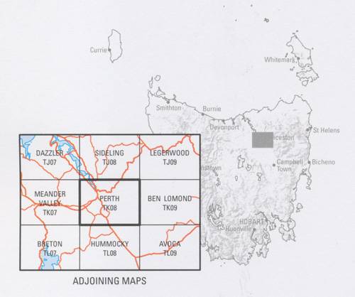
| Latitude Range: | 41° 22.23′ S – 41° 38.5′ S |
| Longitude Range: | 147° 0.0′ E – 147° 28.82′ E |
| Format: | Folded Map |
| Approx Print Size: | 0.6m X 1.07m |
| Publication Date: | 2018 |
ISBN 9318923027686


