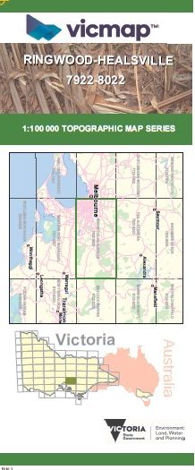

RINGWOOD HEALSVILLE 1-100,000 Vicmap 7922-8022
$14.00
Description:
RINGWOOD HEALSVILLE 1-100,000 Vicmap 7922-8022 NOW PRINT ON DEMAND is used for Walking, 4WD, Fishing, Camping, Motorcycle, both On and Off Road, Gold Prospecting and for those simply going for a family weekend drive.
This is a new series of 1-100,000 scale maps, all of Victoria is covered by these maps.
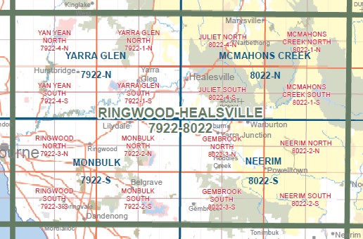
Topographical maps show not only Contours of the Terrain but Walking Tracks, Sealed and Unsealed Roads, Rivers, Creeks, Lakes, Historical Points of Interest, Old Mine Sites mbtg and National and State Park areas.
Main Features of this map includes:
Sububan Malbourne from Whittlesea, Epping, Preston, Hawthorn, Kooyong, Sandringham, Mordialloc, Dandenong, Wantirna, Vermont, Warrandyte, Hurstbridge, Hallam, Beaconsfield Upper, Belgrave, Lysterfield, Mount Dandenong, Coldstream.
Regional Areas covered include Yarra Glen, St Andrews, Steeles Creek, Dixons Creek, Strathewan, Kinglake, Toolangi, Mount Saint Leonard, Chum Creek, Castella, Healesville, Seville, Worri Yallock, Emerald, Gembrook, Cardinia Reservoir, Pakenham, Kurth Kiln, Hoddle Creek, Gladysdale, Launching Place, Yarra Junction, Warburton, Mount Donna Buang, Mount Julirt, Mount Dom Dom, Mount Monda, Narbethong, Mount Murrundindi, Marysville, Mount Boobyalla, O’Shannassy Reservoir, Mount Tugwell, McMahons Creek, Upper Yarra Dam, Reefton, Big Pats Creek, Powelltown, Spion Kopje, Gentle Annie, Neerim, Noojee, Loch Valley, Cambarville, Lake Mountain
You may also like…
-
Neerim 1-50,000 Vicmap
Price range: $12.00 through $26.00Select options This product has multiple variants. The options may be chosen on the product page -
Yarra Glen 1-50,000 Vicmap
Price range: $12.00 through $24.00Select options This product has multiple variants. The options may be chosen on the product page -
McMahons Creek 1-50,000 Vicmap
Price range: $12.00 through $26.00Select options This product has multiple variants. The options may be chosen on the product page -
Monbulk 1-50,000 Vicmap
Price range: $12.00 through $24.00Select options This product has multiple variants. The options may be chosen on the product page