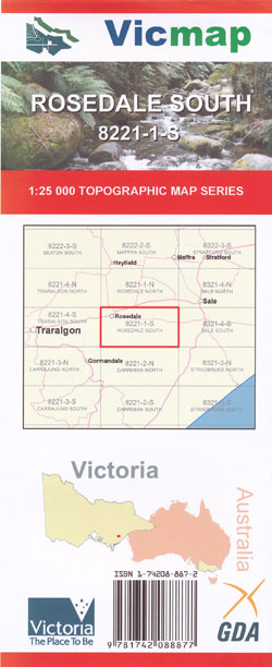
Rosedale South 1-25,000 Vicmap Topo Map 8221-1-S
Price range: $12.00 through $24.00
Description:
Rosedale South 1-25,000 scale Vicmap Topographical map 82211S is used for Walking, 4WD, Fishing, Camping, Motorcycle, both On and Off Road, Gold Prospecting and for those simply going for a family weekend drive.
This is a new series of 1-25,000 scale maps, only certain sections of Victoria are covered by these maps.
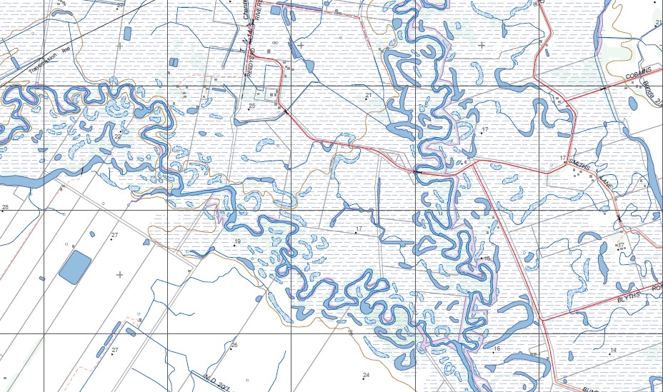
Topographical maps show not only Contours of the Terrain but Walking Tracks, Sealed and Unsealed Roads, Rivers, Creeks, Lakes, Historical Points of Interest, Old Mine Sites mbtg and National and State Park areas.
Main Features of this map includes:
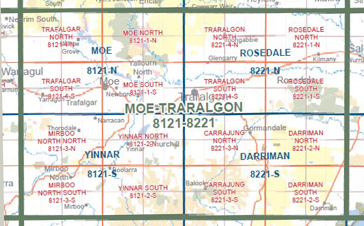
Covers the old series Rosedale and Holey Hill 1-25,000 Vicmaps
Rosedale, A large Northern Section of Holey Plains State Park, La Trobe River, Very fast drivers, MERRIMANS CREEK FR, Holey Hill Camping Area, Kilmany South, Ben Winch Swamp, Craig Swamp, Clear Water Lake, Pearsondale
You may also like…
-
ROSEDALE NORTH 1-25,000 Vicmap Topo Map 8221-1-N
Price range: $14.00 through $26.00Select options This product has multiple variants. The options may be chosen on the product page -
Rosedale 1-50,000 Vicmap
Price range: $12.00 through $24.00Select options This product has multiple variants. The options may be chosen on the product page -
Walhalla Woods Point Adventure Map Rooftop
Price range: $12.95 through $25.00Select options This product has multiple variants. The options may be chosen on the product page -
Seacombe 1-50,000 Vicmap
Price range: $12.00 through $24.00Select options This product has multiple variants. The options may be chosen on the product page -
Darriman 1-50,000 Vicmap
Price range: $12.00 through $24.00Select options This product has multiple variants. The options may be chosen on the product page