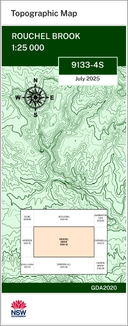
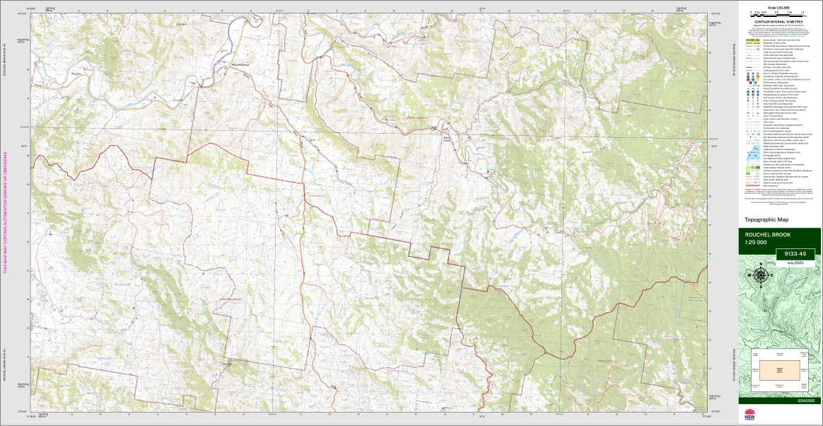
Rouchel Brook 1-25,000 NSW Topo Map 9133-4-S
Price range: $16.95 through $28.95
Description:
Rouchel Brook 1-25,000 NSW Topographic Map 9133-4-S Print on Demand
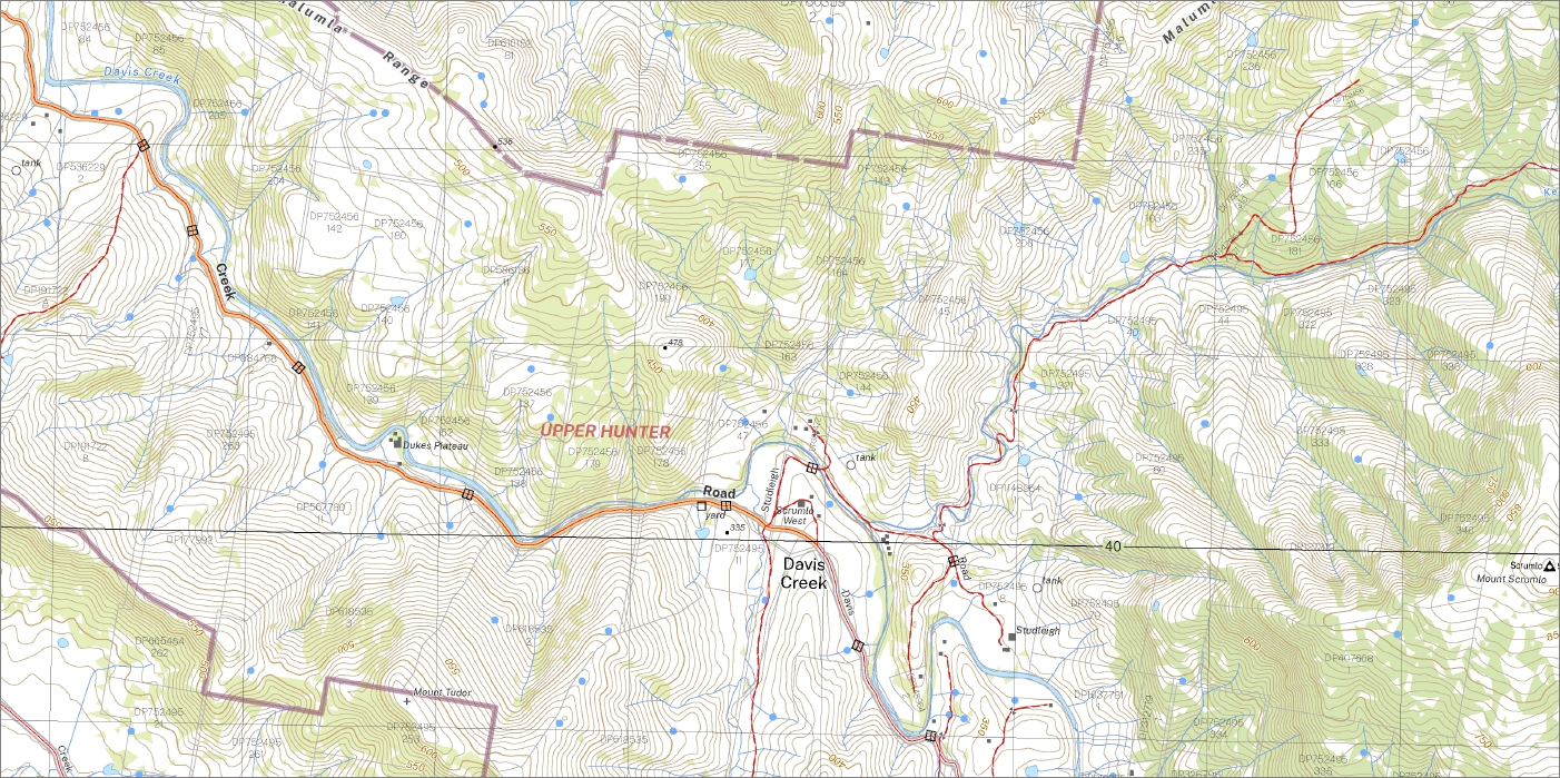
Albano Alexander Creek Bells Mount Bells Mount Range Big Brother Blue Gum Top Blind Gully Blind Creek Bowmans Creek Brush Creek Brush Gully Campbells Creek Darkie Hill Davis Creek Dusty Creek Fish Hole Creek Foy Gins Creek Goorangoola Creek Gushstone Gully Hartletts Creek Herschell Hilliers Creek Hilliers Knob Kangaroo Keans Creek Darkie Dunbars Creek Foy Brook Left Branch Limestone Creek Lincoln Creek Lincolns Creek Little Brother Little Brothers Little Time Creek Mccullys Gap Manwarren Creek Native Dog Native Dog Gully Native Dog Hill Neilin Creek North Brother Oaky Creek Oaky Gully Parsons Bog Rainbow Creek Right Branch of Keans Creek Rouchel Rouchel Brook St Aubins Sawyer Gully Sawyers Gully Scrumlo Scrumlo Creek Scrumlo Gully Mount Scrumlo Scrumlo Range Scrumlo Ridge Spring Gully Stoney Creek Stony Creek Stringybark Creek The Brothers The Knob Timor Creek Tudor Mount Tudor Tudor Ridge Wallaby Hill Waterfall Gully Wheelabout Angles Yorks Gully Bullock Ridge Dry Creek Underbank Dunbar Creek Left Branch of Keans Creek Bridgelands Grenell Park
| Name: | Rouchel Brook |
| Publisher: | New South Wales Government |
| Scale: | 1:25.000 |
| Latitude Range: | 32° 7.5′ S – 32° 15.0′ S |
| Longitude Range: | 151° 0.0′ E – 151° 15.0′ E |
| Datum: | GDA 2020
Edition 2025 |
| Approx Print Size: | 0.56m X 1.11m |
You may also like…
-
Carrabolla 1-25,000 NSW Topographic Map
Price range: $16.95 through $31.95Select options This product has multiple variants. The options may be chosen on the product page -
Ingar 1-25,000 NSW Topographic Map
Price range: $16.95 through $31.95Select options This product has multiple variants. The options may be chosen on the product page -
Carrowbrook 1-25,000 NSW Topographic Map
Price range: $16.95 through $31.95Select options This product has multiple variants. The options may be chosen on the product page -
Barrington Tops 1-25,000 NSW Topographic Map
Price range: $16.95 through $28.95Select options This product has multiple variants. The options may be chosen on the product page -
Woolooma 1-25,000 NSW Topographic Map 9133-4-N
Price range: $16.95 through $28.95Select options This product has multiple variants. The options may be chosen on the product page