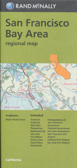
San Francisco Bay Area Map Rand McNally
$17.95
1 in stock
Description:
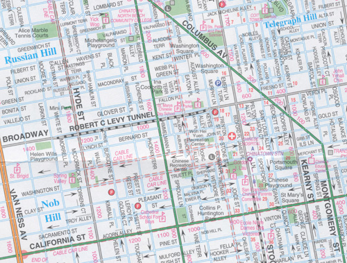
Rand McNally’s folded map for San Francisco Bay Area is a must-have for anyone traveling in and around this part of California, offering unbeatable accuracy and reliability at a great price. Our trusted cartography shows all Interstate, U.S., state, and county highways, along with clearly indicated parks, points of interest, airports, county boundaries, and streets. The easy-to-use legend and detailed index make for quick and easy location of destinations. You’ll see why Rand McNally folded maps have been the trusted standard for years.
- Publisher : Rand McNally
- Language : English
- Map : 2 pages
- ISBN-10 : 0528008021
- ISBN-13 : 9780528008023
- Item Weight : 1.6 ounces
- Dimensions : 4.25 x 0.5 x 8.75 inches
| ISBN | 9780528008023 |
| Coverage Area | Communities include: Fremont, Oakland, Palo Alto, Pleasanton, Redwood City, San Jose, San Mateo, Santa Clara, Santa Rosa, Sunnyvale |
Read More