
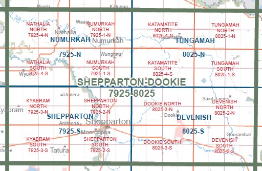
SHEPPARTON DOOKIE 1-100,000 Vicmap Topo 7925-8025
$14.00
Description:
SHEPPARTON DOOKIE 1-100,000 Vicmap Topographic Map 7925-8025 NOW PRINT ON DEMAND is used for Walking, 4WD, Fishing, Camping, Motorcycle, both On and Off Road, Gold Prospecting and for those simply going for a family weekend drive.
This is a new series of 1-100,000 scale maps, all of Victoria are covered by these maps.
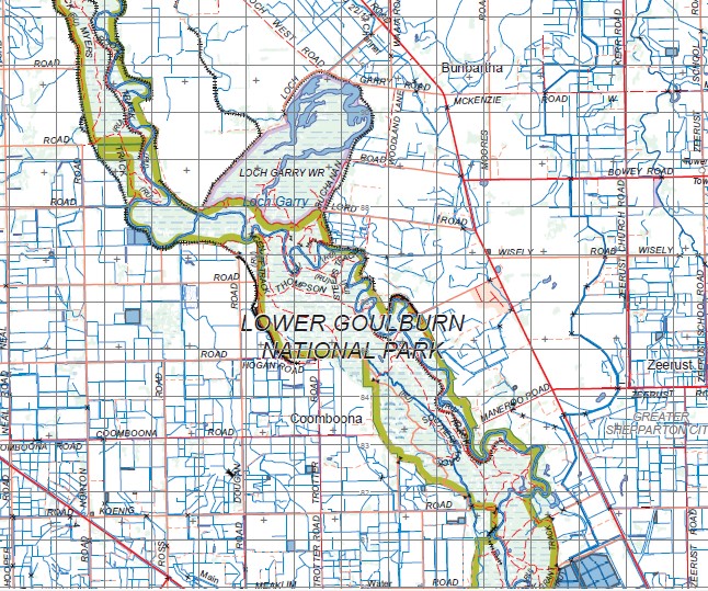
Topographical maps show not only Contours of the Terrain but Walking Tracks, Sealed and Unsealed Roads, Rivers, Creeks, Lakes, Historical Points of Interest, Old Mine Sites and National and State Park areas.
Main Features of this map includes:
Shepparton, Dookie, Numerkah, Natalia Katamatite, Kyabram, Picola, Goulburn River, Yambuna, LOWER GOULBURN NATIONAL PARK, Wyuna, Merrigum, Girgarre, Stanhope, Girgarre East, Tatura, Ardmona, Mooroopna, Undera, Kotupna, Nathalia, Yalca South, Katunga, Waaia, Wunghnu, Wunghnu, Mooroopna, Kialla West, Shepparton Regional Park, Kialla East, Tallygaroopna, Katandra West, Katamatite, Dunbulbalane, Yabba Nort, Yabba South, Mount Major, Cosgrove South, Nalinga, Gowangardie, Caniambo, Tamleugh North, Upotipotpon, Waggarandal, Youarang, Boosey, Burramine South, Tungamah, Devenish, Nooramunga, Goorambat, Chesney, Bungeet West, Lake Rowan, Wilby, the edge of Yarrawonga
You may also like…
-
Numurkah 1-50,000 Vicmap
Price range: $12.00 through $24.00Select options This product has multiple variants. The options may be chosen on the product page -
Shepparton 1-50,000 Vicmap Topographic Map 7925-S
Price range: $14.00 through $26.00Select options This product has multiple variants. The options may be chosen on the product page -
Bendigo 1-250,000 Topographic Map GA
Price range: $15.95 through $27.95Select options This product has multiple variants. The options may be chosen on the product page -
Tungamah 1-50,000 Vicmap
Price range: $12.00 through $24.00Select options This product has multiple variants. The options may be chosen on the product page -
Devenish 1-50,000 Vicmap
Price range: $12.00 through $24.00Select options This product has multiple variants. The options may be chosen on the product page