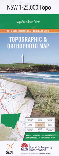
Sofala 1-25,000 NSW Topographic Map
$16.95 – $31.95
Description:
8831-4-N Print on Demand
Glen Maye Blairgowrie Pomanara Clare Hills Killarney Nalya Karinya Yarrawonga Maitland Camp Avila Crudine Cannindah Round Hill Sunrise Weeora Booderoo Marawaylee Kentucky Willow View Pen-Phreol Turondale Park Mountain View Chesleigh Duna Fairview Bald Hills Bald Hills Creek Bathurst Point Bells Creek Bells Falls Bobs Creek Mount Bluey Bourke Creek Box Ridge Creek Bridge Creek Buckleys Creek Campbells Gully Church Gully Cockatoo Hill Cole Gully Commissioners Hill Cookmans Creek Cunningham Deep Gully Devils Pinch Eight Mile Ridge Erksine Flat Erskine Island Four Mile Creek Golden Point Gollahers Bald Hill Green Point Groses Gully Half Moon Gully Heaths Point Insolvent Hill Kangaroo Flat Campbells Creek Church Creek Deep Creek Eight Mile Range The Gulf Half Moon Creek Jews Creek Kurrajong Hill Lambs Creek Lamfords Gully Langfords Gully Lindberry Gully Little Bald Hill Little Oaky Creek Little Wallaby Rocks Lower Wallaby Lucky Point Mcguinness Creek Maitland Point Maitland Swamp Merrions Middle Bald Hill Middle Creek Monkey Monkey Hill Mount Parwar New Zealand Point Oakey Creek Oaky Hill Oaky Knob Patterson Point Pennyweight Flat Pennyweight Flat Creek Pennyweight Ridge Pine Creek Pine Gully Pomanara Creek Ration Point Ration Hill Red Hill Ryans Gully Sallys Flat Salt Hill Sampsons Marbles Scabby Hill Sheeps Head Sheep Station Creek Sheep Station Point Skid Hollow Creek Skid Hollow Gully Sofala Sofala Cemetery Sofala General Cemetery Sofala Park Sofala Public School Town of Sofala Spring Creek Surface Hill Mount Tanwarra Taylors Hill The Reefs Thompsons Point Tripeys Creek Tripeys Gully Tripleys Creek Turondale Two Mile Creek Upper Wallaby Wallaby Point Wallaby Rocks Waterbeach Whalans Hill Wickers Creek Wicketts Creek Bullock Horn Gully Dry Flat Creek Dry Creek Bushrangers Creek Box Ridge Crudine Creek
| Name: | Sofala |
| Publisher: | New South Wales Government |
| Scale: | 1:25000 |
| Latitude Range: | 33° 00.0′ S – 33° 7.5′ S |
| Longitude Range: | 149° 30.0′ E – 149° 45.0′ E |
| Datum: | GDA 94 |
| Approx Print Size: | 0.56m X 1.11m |

