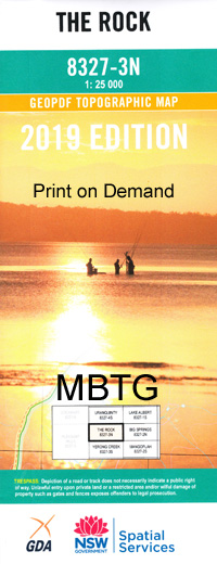
The Rock 1-25,000 NSW Topographic Map
Price range: $16.95 through $31.95
Description:
8327-3-N Print on Demand
Locations within this Map
The Rock Birdlip Birdlip Station Deadmans Gully Flowerpot Hill Lake Gilman Hanging Rock Dead Mans Creek Kubura Kubura Crossing Kubura Railway Station Little Rock Hill Mangoplah North Mangoplah Railway Station Oxley Pearson Pearson Public School Plahgoman The Rock Hill Rocks Brother Stony Creek The Rock Central School The Rock Faunal Reserve The Rock Nature Reserve The Rock Post Office The Rock Railway Station Village of The Rock Tootool Tootool Railway Station Vincent Wattle Creek Bulloc Bulloc Bulloc Hill Burke Rocks Brother Hill Roseleigh Avalon Miarb Pulletop Creek Yerong Creek Tank
| Name: | The Rock |
| Publisher: | New South Wales Government |
| Scale: | 1:25000 |
| Latitude Range: | 35° 15.0′ S – 35° 22.5′ S |
| Longitude Range: | 147° 0.0′ E – 147° 15.0′ E |
| Datum: | GDA 94 |
| Approx Print Size: | 0.56m X 1.11m |
Read More