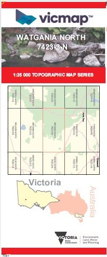
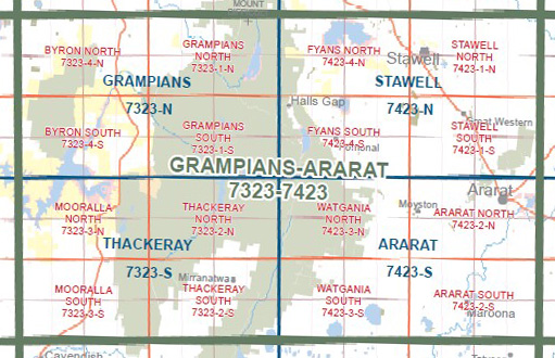
WATGANIA NORTH 1-25,000 Vicmap Topo Map 7423-3-N
Price range: $14.00 through $26.00
Description:
WATGANIA NORTH 1-25,000 Vicmap Topographic Map 7423-3-N Walking, 4WD, Fishing, Camping, Motorcycle, both On and Off Road, Gold Prospecting and for those simply going for a family weekend drive.
This is a new series of 1-25,000 scale maps, all sections of Victoria are now covered by these maps, including maps over the South Australian and NSW Borders.
Topographical maps show not only Contours of the Terrain but Walking Tracks, Sealed and Unsealed Roads, Rivers, Creeks, Lakes, Historical Points of Interest, Old Mine Sites and National and State Park areas.
Main Features of this map includes:
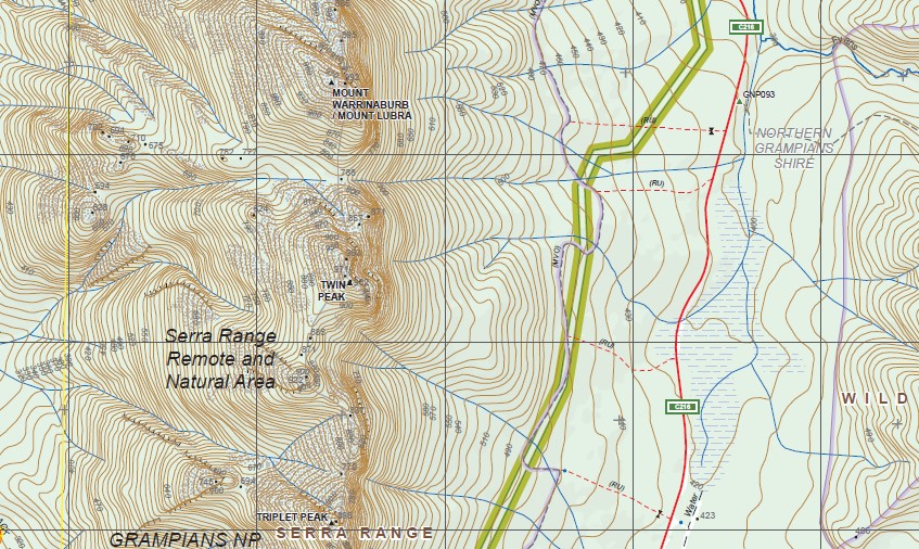
Covers the old edition Mount William which is out of print and the old edition Barton map
Mount William, Mount William Range, Major Mitchell Plateau Remote and Natural Area, MOYSTON FR, MOUNT WARRINABURB / MOUNT LUBRA, Twin Peaks, Serra Range Remote and Natural Area, The BAsin, TRIPLET PEAK, Mount Frederick, MOUNT YARANULA / MOUNT LANG, Ingleton Fireline Bush Camp, Teddy Bear Gap, Jimmy Creek Campground, Mafeking, First Wannon Creek Gorge, Grasstree Creek Reference Area no public access, Wild Sheep Hills, Bovine Hills, The Seven Dials, Perch Rock, Dirag Gap (Boundary Gap), Murray Hill, Watgania Gap, Kalymna Campground, Nekeeya Swamp
You may also like…
-
WATGANIA SOUTH 1-25,000 Vicmap Topo Map 7423-3-S
Price range: $14.00 through $26.00Select options This product has multiple variants. The options may be chosen on the product page -
Ararat 1-50,000 scale Vicmap Topo Map 7423-S
Price range: $12.00 through $24.00Select options This product has multiple variants. The options may be chosen on the product page -
GRAMPIANS ARARAT 1-100,000 Vicmap 7323-7423
Price range: $14.00 through $26.00Select options This product has multiple variants. The options may be chosen on the product page