
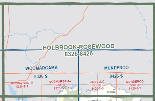
WOOMARGAMA SOUTH 1-25,000 Vicmap Topo 8326-2-S
Price range: $14.00 through $26.00
Description:
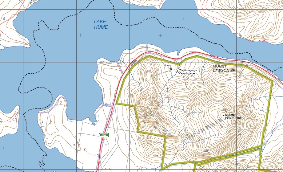
WOOMARGAMA SOUTH 1-25,000 Vicmap Topographic Map 83262S Now Print On Demand is used for Walking, 4WD, Fishing, Camping, Motorcycle, both On and Off Road, Gold Prospecting and for those simply going for a family weekend drive.
This is a new series of 1-25,000 scale maps, all of Victoria is now covered by these maps, including maps over the South Australian and NSW Borders.
Topographical maps show not only Contours of the Terrain but Walking Tracks, Sealed and Unsealed Roads, Rivers, Creeks, Lakes, Historical Points of Interest mbtg, Old Mine Sites mbtg and National and State Park areas.
Main Features of this map includes:
Part of Lake Hume and the Murray River
Part of the Hume and Hovell Walking Track, Samuel Bollard Campsite, Thologolong, Mother Duff, Mount Lawson State Park, The Kurrajongs Camping Area, MOUNT PORCUPINE
You may also like…
-
BOWNA SOUTH 1-25,000 Vicmap Topo Map 8326-3-S
Price range: $14.00 through $26.00Select options This product has multiple variants. The options may be chosen on the product page -
Woomargama 1-50,000 Vicmap
Price range: $12.00 through $24.00Select options This product has multiple variants. The options may be chosen on the product page