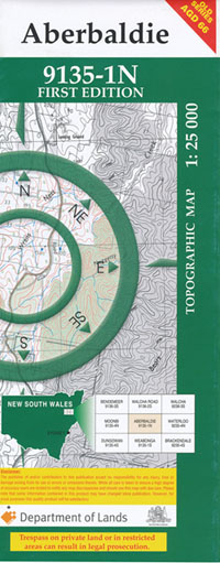
Aberbaldie 1-25,000 NSW Topographic Map
$16.95 – $31.95
Description:
Aberbaldie 91351n 1-25,000 scale NSW Topographical map is used for Walking, 4WD, Fishing, Camping, Motorcycle, both On and Off Road, Gold Prospecting and for those simply going for a family weekend drive.
Topographical maps show not only Contours of the Terrain but also Walking Tracks, Sealed and Unsealed Roads, Rivers, Creeks, Lakes, Historical Point of Interest, Old Mine Sites and National and State Park areas.
This map includes the following localities: The Grange Sunny Corner Ruby Hill Ulindra Masonvale Pine Hills Rangers Vale Willowtree Back Creek Clovernook Marinka Boxley Einnor Clyde Mary Gray Glenelg Kilburnie Mulverindie Craigdarroch Sunnyside The Tops Caubaune Sirene Glenalyn Aberbaldie Blair Athol Inverary Mooramong Anna Alicks Swamp Alicks Swamp Creek The Big Hill Boulton Branch Creek Brick Wall Creek Callaghans Creek Callaghans Gully Cauborn Creek Cobrabald Cobrabald Mountain Fairy Ground Creek High Mountain Inglis Jail Creek Moggs Gully Murphys Gap Parsons Gully Pipeclay Gully Scott South Burke Ugly Gully Aberbaldie Nature Reserve
| Scale: | 1:25000 |
| Latitude Range: | 31 00.0 S – 31 07.5 S |
| Longitude Range: | 151 15.0 E – 151 30.0 E |
| Approx Print Size: | 0.56m X 1.11m |
| Projection: | Transverse Mercator |
Laminated and folded NSW Topographical map $12.00 see below


