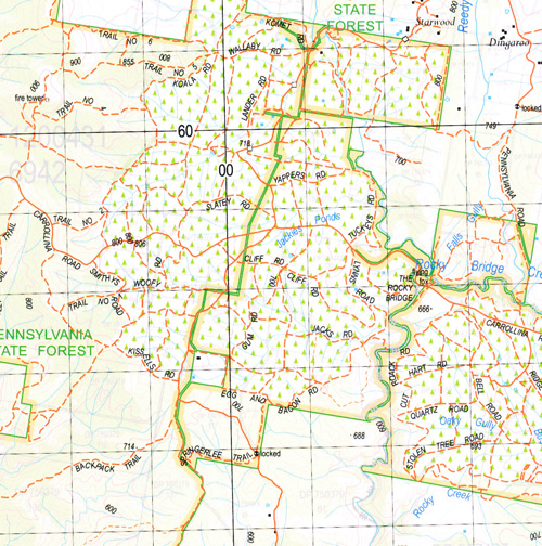
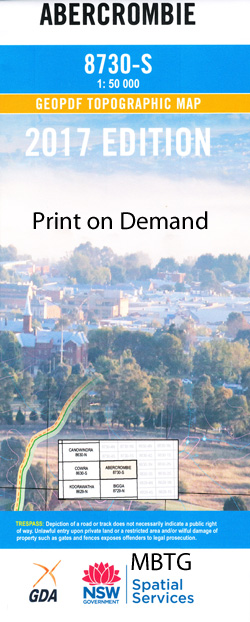
Abercrombie 1-50,000 NSW Topographic Map
$16.95 – $31.95
Description:
8730-S Print on Demand
Locations within this Map
Alum Falls Alum Gully Arkell Arkell Range Arkell Ridge Back Creek Alexander Arthur of Trunkey Creek Alum Creek Abercrombie Village of Abercrombie Abercrombie Caves Bald Hill Bald Hill Creek Bald Ridge Creek Barragans Mountains Barragans Mount Bartletts Creek Bells Bells Creek Or Hells Hole Creek Belmore Creek Belmore Dam Bessy Flat Bessys Flat Black Hill Spring Blackhill Creek Binghams Back Creek Boiling Down Gully Bombah Bombah Flat The Boss Mountain Boundary Creek Bucumba Bucumba Sugarloaf Camp Creek Captain Cook Lookout Carrawa Carrawa Creek Chicken Creek Coodah Coodah Creek Copperhannia Copperhannia Creek Copperhannia Nature Reserve Croakers Gully Mount Crocker Crocker Crockwell Mount Crockwell Curragh Curragh Creek Davies Mount Davies Davis Creek Decca Decca Creek Decca Hill Deep Creek Egbert Falls Gully Fat Cattle Creek Forest Fulton Gap Garden Creek Giants Dyke Mountain Grabine Grabine State Recreation Area Mount Gray The Great Arch Greenmantle Grove Creek Falls Groveland Grundys Flat Gulf Creek Gulf Gully Hammonds Creek Hells Hole Hells Hole Creek Hobcroft Hobcroft Defence Howard Hunts Creek Jackies Ponds Johnsons Creek Juvenile Kempfield Kempfield Sugarloaf Captain Cook Memorial Lookout Chain of Ponds Creek Colo Creek Crooked Tree Creek Mount Davis Falls Creek General Cemetery At Jinjera Great Dividing Range Green Gully The Gum Flat Kavenachs Flat Leakes Licking Hole Creek Licking Hole Creek Little Bread Creek Little Curragh Creek Little Hells Hole Creek Little Wild Cattle Creek Mckenzies Flat Mcquires Flat Matts Tower Meadow Paddock Creek Middle Creek Mile Creek The Mile Gully Mount Misery Moores Creek Moores Flat Morris Point Mountain Run Creek Mulgunnia Mulgunnia Creek Native Dog Creek Navens Creek Navens Gully Oaky Creek Oaky Gully Old Trunkey Old Womans Creek Old Yard Creek One Eye One Eye House Paddys Pinnacle Peisleys Creek Pembroke Phoebes Creek Phoebes Gully Piesleys Creek Pine Ridge Pot O’Tea Creek Pretty Creek Purfleet Quart Pot Quarry Creek Ram Hill Rams Hill Razor Back Range Reeds Creek Ramarkable Pinnacle The Rocky Bridge Rocky Creek Roseberg Roseberg State Forest Rough Gully Round Hill Ryan Mount Ryan Sallys Creek Sam Hunts Creek Sandy Creek Sawpit Creek Sawpit Gully Scabben Flat Sounder Sounder Flat Spicers Creek Spicers Mountain Splitters Creek Spring Spring Creek Spring Gully Stoke Streanville Streamville Creek Sugarloaf Sunny Hill Creek Taraville Creek Teatree Creek The Back Flat The Little Forest The Red Camp The Sounding Rock Tranters Flat Trap Rock Trunkey Creek Trunkey Creek Cemetery Trunkey Trunkey Cemetery Trunkey Creek Public School Trunkey Public School Trunkey or Mulgunnia Creek Tunnel Point Waterfall Creek Websters Creek Wide Creek Wild Cattle Creek Wildyard Wild Yards Creek Willow Glen Creek Mount Wilson Woolshed Creek Wyangala National Park Wyangala State Recreation Area Wyangala Waters Park Yarraman Yarraman Ridge Bumble Top Mountain Diamond Creek Douglas Gully Diamond Valley The Diamond Valley Dirt Hole Creek Double Topper Mountain Bushranger Hill Bushrangers Creek The Bushranger Butchers Flat Byrnes Creek Coops Bluff Pennsylvania State Forest Latins Hole Round Water Hole Bald Ridge Colo Mount Mckenzie The Gulf Grabine Lakeside State Park Wyangala Waters State Park Garland Abercrombie River Triangle Flat Stringy Bark Range Long Swamp Fulton Hill Graingers Creek Arthur Rocky Bridge Creek Grove Creek Peelwood Creek Thompsons Creek Tuena Creek Blackmans Creek Meglo Creek Cooks Vale Creek
| Name: | Abercrombie |
| Publisher: | New South Wales Government |
| Scale: | 1:50000 |
| Latitude Range: | 33° 45.0′ S – 34° 0.0′ S |
| Longitude Range: | 149° 0.0′ E – 149° 30.0′ E |
| Datum: | GDA 94 |
| Approx Print Size: | 0.56m X 1.11m |


