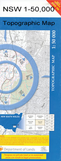
Albury 1-50,000 NSW Topographic Map
$16.95 – $31.95
Description:
Albury 8225N 1-50,000 scale NSW Topographical map is used for Walking, 4WD, Fishing, Camping, Motorcycle, both On and Off Road, Gold Prospecting and for those simply going for a family weekend drive.
Topographical maps show not only Contours of the Terrain but also Walking Tracks, Sealed and Unsealed Roads, Rivers, Creeks, Lakes, Historical Point of Interest, Old Mine Sites and National and State Park areas.
 We can Now LAMINATE and fold your map for $12.00. Just click on the image and add to the Trolley
Lagoon Corner Darkies Hill Devils Glen Eastern Eastern Hill Eastern Hill Lookout Eight Mile Creek Forrest Hill Park Glen Park Greenfield Park Greens Creek Hamilton Hamilton Valley Creek Herridge Hodge Island Hodge Island Reserve Horseshoe Lagoon Hovell Tree Reserve Humbug Gully Hume Public School Jindera Hills Jingera Jingera Lagoon Collins Park Corrys Hamilton Valley Hovell Tree Park Jindera Hill Jingera Lagoon Lambert Park Lavington Lavington Memcsial Oval Lavington Oval Lavington Public School Lester Lesters Gully Lesters Lagoon Marks Park Mayday Hill Mount Miser Mounment Monument Hill Moresby Park Muddy Dam Reserve Mulyans Well Mungabarina Lagoon Mungabareena Reserve Mungabarina Ford Mungabarina Reserve Murray High School Nailcan Hill Nailcan Hill Reserve Noreuil Park Norris Norris Hill Olive Street One Tree Hill Pioneer Park Quicks Hill Red Hill Red Hill New Rocky Hill Seven Mile Creek Sheep Dip Lagoon Splitters Creek Springdale Heights Springdale Heights Public School Stony Creek Stony Gully Sunwood Park Thurgona Public School Thurgoona Public School Waites Lagoon Waites Lagoon Reserve Wewak Street Public School Willow Bank Wilson Hill Mount Wilson Woolshed Creek Dights Creek Dights Hill Doctors Point Doctors Point Reserve Douglas Gully Douglas Creek Bungamba Bungambrawatha Creek Channel Bungambrawatha Creek Bungowannah Mungabareena Kandeer School Albury Airfield Glenroy Avis Park Bunton Park East Albury Ettamogah Fellowes Park Frederick Park Fromholtz Park J C King Park Majella Park Mates Park Melrose Park North Albury Sarvaas Park South Albury West Albury Uiver Park James Fallon High School Botanic Gardens Hamiltons Gully Jingera Jingers Lagoon Jelbart Park Padman Park Lavington Pioneer Park Alan Cracknell Park Alan Goyne Park Albert Terrill Reserve Alma Rogers Park Almonds Recreation Reserve Bandiana Golf Course Bandiana Military Post Office Bandiana Primary School Barambogie Barambogie Creek Baranduda Baranduda Fire Station Baranduda Primary School Baranduda Range Baranduda Telephone Exchange Barnawartha Barnawartha Fire Station Barnawartha North Barnawartha Primary School Barnawartha South Bears Belvoir Park Belvoir Special Developmental School Belvoir West Bill Black Park Bill Orr Park Doma Mungi Creek Bogong Bonegilla Bye Creek Carl Fietz Park Charles Ryan Park Cheesley Hill Chiltern Bush Nursing Hospital Chiltern Fire Station Chiltern Police Station Chiltern Post Office Chiltern Primary School Chiltern Railway Station Chiltern Valley Recreation Reserve Chiltern West Clyde Cameron Reserve Cornishtown Fire Station Cornishtown Public Hall David Bayne Park David Winterbottom Park Deep Creek Dr Bill Grant Park Dr John Schlink Park Draper Hill Drapers Hill Gimlet Creek Ernest Condon Park Ewart Brothers Reserve Felix Grundy Park Fell Timber Creek Fryingpan Creek Gamble Singh Park Gap Creek Gerard Moylan Park Gooramadda Gooramadda Fire Station Gooramadda Public Hall Gordon Craig Park Graham Andrew Park Henry Harkin Park Henry Nowik Park Huons Creek Huons Hill Huons 1 Huons 2 Indigo Creek Indigo Valley Indigo Valley Fire Station Ironbark Hill Jack Eames Reserve Jack In The Box Creek James Taverney Park Jim Matthews Park John Aney Park Julia Ronan Park Kelly Park Kent McKoy Reserve Kiewa Valley Highway Start Kit Hughes Park Kitcheners Bridge Klings Hill Kookaburra Creek Lady Franklin Lake Anderson Leneva Fire Station Leneva Primary School Leneva Public Hall Les Stone Park Lincoln Causeway Little Pilot Lou Lieberman Park Magenta Mine Masts Max Gray Park McDonalds Hill Melrose Primary School Merle Mason Park Middle Creek Middle Indigo Primary School Mount Barambogie The Kookaburra Mount Ochtertyre Mount Ophir Mulleena Special School Murphys Bridge Pam Stone Park Pat Parker Athletics Park Peter Frawley Senior Park Phill Adams Park Pilot Creek Rex Chamberlain Park Robert Prentice Park Rocky Waterholes Creek Rose Hill Russell Cochrane Park Rutherglen Research Station Ryan Creek Sams Bridge Sugarloaf Hill Sawpit Bridge Sawpit Creek Shingle Hill Skeleton Hill Staghorn Flat Staghorn Flat Post Office Stockyard Creek Sumsion Gardens Tyrells Hill Tom Hales Park Union Bridge Wattle Park Westlands Whytes Log Hill William Moulder Park Willow Park Wodonga Creek Wodonga Fire Station Wodonga Hospital Wodonga Magistrates Court Wodonga West Secondary College Wodonga Technical School Wodonga Police Station Wodonga Post Office Wodonga Primary School Wodonga Racecourse Wodonga Rural City Wodonga Senior Secondary College Wodonga South Primary School Wodonga West Primary School Woodland Grove Woorragee North Dead Mans Creek North Prentice Thurgoona Browns Plains Albury Municipality Indigo Mount Lady Franklin Christmastown Kiewa River Chiltern Valley Wooragee North Middle Indigo Bandiana Springhurst Yackandandah Creek Leneva Indigo Upper
| Name: | Albury |
| Publisher: | New South Wales Government |
| Scale: | 1:50000 |
| Latitude Range: | 36° 00.0′ S – 36° 15.0′ S |
| Longitude Range: | 146° 30.0′ E – 147° 0.0′ E |
| Datum: | GDA 94 |

