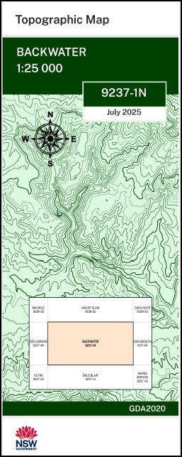
Backwater 1-25,000 NSW Topographic Map 9237-1-N
Price range: $16.95 through $28.95
Description:
Backwater 1-25,000 NSW Topographic Map 9237-1-N
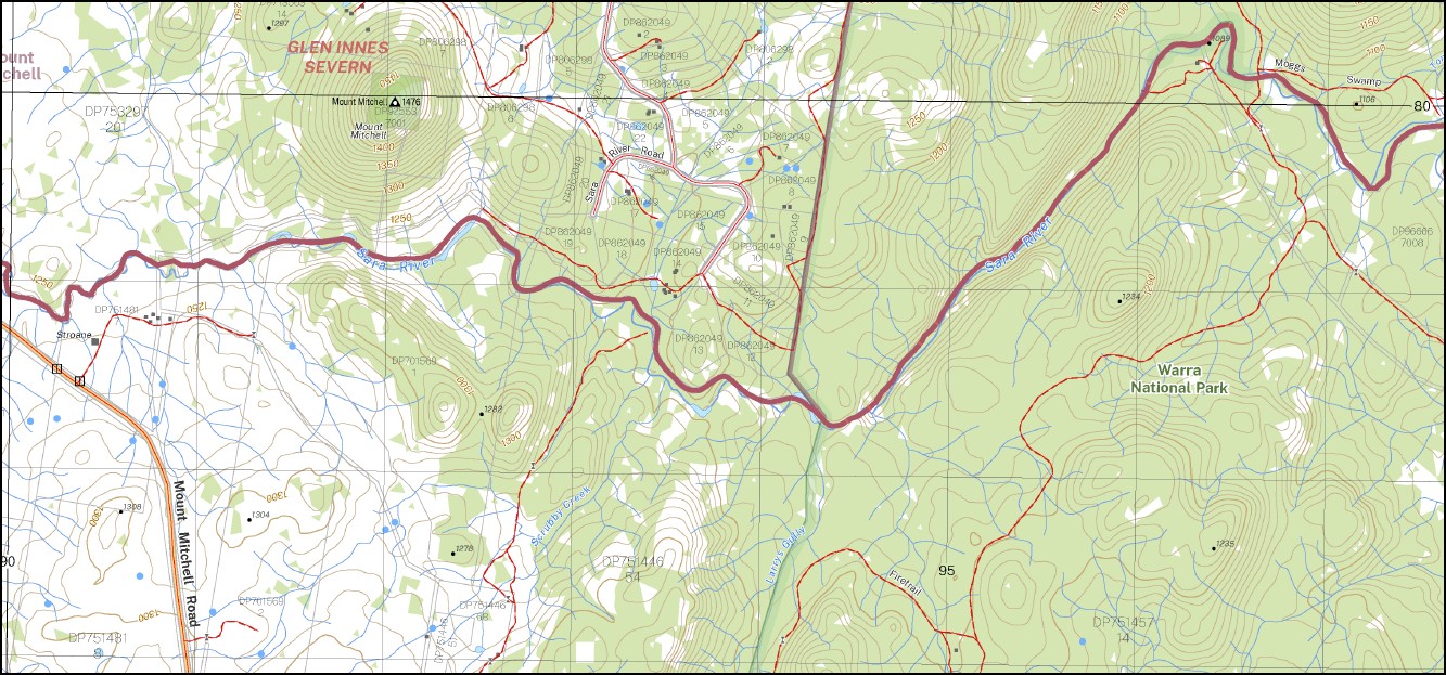
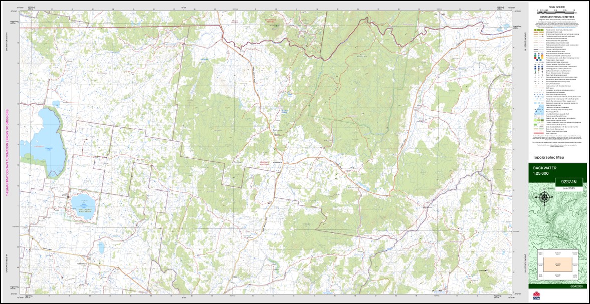
Backwater 92371n 1-25,000 scale NSW Topographical map is used for Walking, 4WD, Fishing, Camping, Motorcycle, both On and Off Road, Gold Prospecting and for those simply going for a family weekend drive.
Topographical maps show not only Contours of the Terrain but also Walking Tracks, Sealed and Unsealed Roads, Rivers, Creeks, Lakes, Historical Point of Interest, Old Mine Sites and National and State Park areas.
 Laminate and folded this NSW Topographical map, $12.00 see below.
This map includes the following localities: Ben Nevis Glengare Tirranna Bulwarra Braeside Ashwood Strone Fyfes Barretts Wattle Ridge Tyla Forest Foxforth Tel-El-Fara Haystack Trentham Sandy Farm Willow Green Clodagh Abbey Green Rosehill Sunnyside Bonnie Dell Black Farm Iona Oban Ann River Greenrock Leawarra The Folly Backwater Creek Bagot Balancing Rock Beesnest Beesnest Hill Cockatoo Creek Coventry Grey Mares Tail Falls Hall Haystack Rock Humbug Gully Huxhams Gully Kangaroo Gully Larrys Gully Little Llangothlin Lake Little Llangothlin Lagoon Little Llangothlin Nature Reserve Llangothlin Lake Mitchell Mountain Gully Mount Mitchell Mushroom Rock Nairns Gully Mount Nobbler Nobles Gully Oban River Paddys Gully Paddys Gully Cemetery Peters Hill Pigs Swamp Pigs Swamp Creek Racecourse Gully Rooneys Gully Scrubby Creek Sheep Station Gully Sheep Station Swamp Snakes Gully Stuttering Dicks Creek Towagal Tubbamurra Creek Tubbamurra Public School Tubbamurra Swamp Ward Wards Mistake Wet Gully Butchers Creek Butchers Swamp Backwater Lomonds Hill Llangothlin Game Reserve Niels Mountain Tubbamurra
| Scale: | 1:25,000 |
| Latitude Range: | 30 00.0 S – 30 07.5 S |
| Longitude Range: | 151 45.0 E – 152 00.0 E |
| Approx Print Size: | 0.56m X 1.11m |
| Projection: | GDA 2020
Edition 2025 |
You may also like…
-
Red Range 1-25,000 NSW Topographic Map 9238-2-N
Price range: $16.95 through $28.95Select options This product has multiple variants. The options may be chosen on the product page -
Mount Slow 1-25,000 NSW Topographic Map 9238-2-S
Price range: $16.95 through $28.95Select options This product has multiple variants. The options may be chosen on the product page -
Glen Innes 1-25,000 NSW Topographic Map 9238-4-S
Price range: $16.95 through $28.95Select options This product has multiple variants. The options may be chosen on the product page -
Dundee 1-25,000 NSW Topographic Map 9238-1-N
Price range: $16.95 through $28.95Select options This product has multiple variants. The options may be chosen on the product page -
Maybole 1-25,000 NSW Topographic Map 9238-3-S
Price range: $16.95 through $28.95Select options This product has multiple variants. The options may be chosen on the product page -
Rangers Valley 1-25,000 NSW Topo Map 9238-4-N
Price range: $16.95 through $28.95Select options This product has multiple variants. The options may be chosen on the product page