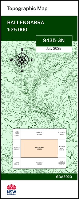
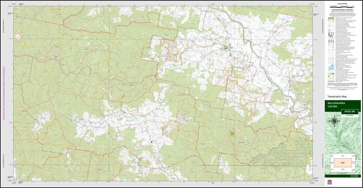
Ballengarra 1-25,000 NSW Topographic Map 9435-3-N
Price range: $16.95 through $28.95
Description:
Ballengarra 1-25,000 NSW Topographic Map 9435-3-N Now Print on Demand
Ballengarra 94353n 1-25,000 scale NSW Topographical map is used for Walking, 4WD, Fishing, Camping, Motorcycle, both On and Off Road, Gold Prospecting and for those simply going for a family weekend drive.
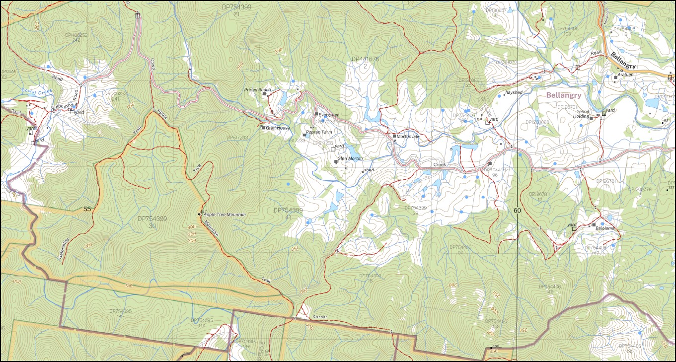
Topographical maps show not only Contours of the Terrain but also Walking Tracks, Sealed and Unsealed Roads, Rivers, Creeks, Lakes, Historical Point of Interest, Old Mine Sites mbtg and National and State Park areas.
This map includes the following localities: Warrabee Wilsbro Eugowra Glamis Scotts Plain Wanda Ville Crystal Brook Willflor Briloaks Ramsay Farm Brilmore Denton Vale Bronte Clairview Mount John Lamefield Linwood Willrana Popanana Yadillah Avelon Aralluen Yennil Holding Hillcrest Orange Grove Shirldon Avenel Crestwood Mortonvale Mount Carmel Lantana Ranch Albert Ballengara Ballengarra Banglow Creek Bellangry Bellangry State Forest Bottlebrush Creek Bottle Brush Creek Bril Bril Creek Bril Bril State Forest Cairncross Mount Cairncross Cairncross State Forest Cobrabald Creek Cogo Coolapatamba Creek Cowal Creek Cundle Creek Five Ways Hill Gum Scrub Cowral Creek Loggy Creek Lower Kings Folly Creek Mortons Creek Pappenbarra State Forest Pappinbarra State Forest Rollands Plains Rudders Creek Stony Creek Apple Tree Mountain Mines Road Flora Reserve Rollands Plains Cemetery Rollands Plains Recreation Reserve Waterfall Creek Bril Bril Slippry Creek Woodlands Park
| Scale: | 1:25,000 |
| Latitude Range: | 31 15.0 S – 31 22.5 S |
| Longitude Range: | 152 30.0 E – 152 45.0 E |
| Approx Print Size: | 0.56m X 1.11m |
| Projection: | GDA 2020
Edition 2025 |
You may also like…
-
Telegraph Point 1-25,000 NSW Topo Map 9435-2-N
Price range: $16.95 through $28.95Select options This product has multiple variants. The options may be chosen on the product page -
Wauchope 1-25,000 NSW Topographic Map 9435-3-S
Price range: $16.95 through $28.95Select options This product has multiple variants. The options may be chosen on the product page -
Kundabung 1-25,000 NSW Topographic Map 9435-1-S
Price range: $16.95 through $28.95Select options This product has multiple variants. The options may be chosen on the product page -
Port Macquarie 1-25,000 NSW Topo Map 9435-2-S
Price range: $16.95 through $28.95Select options This product has multiple variants. The options may be chosen on the product page -
Kempsey 1-25,000 NSW Topographic Map 9435-1-N
Price range: $16.95 through $28.95Select options This product has multiple variants. The options may be chosen on the product page -
Tinebank 1-25,000 NSW Topographic Map 9435-4-S
Price range: $16.95 through $28.95Select options This product has multiple variants. The options may be chosen on the product page