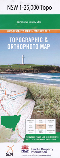
Bilambil 1-25,000 NSW Topographic Map
$16.95 – $31.95
Description:
9541-1-S
Bilambil 95411s 1-25,000 Scale NSW Topographical Map is usedfor Walking, 4WD, Fishing, Camping, Motorcycle, both On and Off Road, GoldProspecting and for those simply going for a family weekend drive.
Topographicalmaps show not only Contours of the Terrain but also Walking Tracks, Sealed andUnsealed Roads, Rivers, Creeks, Lakes, Historical Point of Interest, Old MineSites and National and State Park areas.
 Laminate and folded this NSW Topographical map, $12.00 see below.
This map includes the following localities: Mugumu The Beeches Mount Balfour Balfour Balfour Hill Berwick Best of All Lookout Bilambil Creek Bilambil Heights Bilambil Public School Bilbroughs Lookout Bilinga Hill Bilumbil Creek Boololagung Hill Mount Boololagung Mount Boyung Thuga Bradys Creek Campbell Hill Carool Mount Carool Carool Public School Cobaki Cobaki Creek Colagang Hill Mount Cougal Cougal Duroby Creek Glengarrie Hanging Rock Mount Campbell Mount Colagang Mangrove Island Mays Hill Moolamba Hill Mount Moolamba Mount Boyung Thugai Mount Mumdjin Numinbah Nature Reserve Pauls Grass Piggabeen Piggabeen Creek Piggabeen Public School Reads Lookout Reedy Swamp Schusters Lookout Somerville Mount Summerville Sphinx Lookout Springbrook Mountain Mount Thillinman Mount Thunberrigan Mount Tomewin Upper Bilambil Woodgee Hill Wyberba Mount Wyberba Dixie Lookout Bungalora Outlook Burrigan Mount Burrigan Point Burrigan Quambatook Creek Windley Park Prindable Park Keys Park Pelican Point Lookout East Peak Mount Talganda Colgon West Peak Bilambil Mount Teemangum Cobaki Lakes Bungalora Duroby Mount Somerville Springbrook Adder Creek Bally Mountain Bellaringa Lookout Bijungoolahra Falls Bilbrough Falls Bilbrough Lookout Mount Bilinga Blackfellow Falls Boojerahla Falls Boojerahla Lookout Boojerooma Falls Boololagung Boy-Ull Creek Boyds Butte Boyung Thugai Camp Creek Canyon Lookout Mount Cougal (East Peak) Mount Cougal (West Peak) Currumbin Creek Currumbin Point Currumbin Rock Ee-Jung Creek Elephant Rock Fairview Mountain Flat Rock Flat Rock Creek Mount Gannon Garden of Eden Goomoolahra Lookout Gooroolba Falls Hell Hole Horseshoe Falls Ingleside Kadjagooma Falls Kuralboo Creek Little Bally Mountain Little Nerang Creek (East Branch) Little Nerang Creek (West Branch) Little Nerang Dam Moffat Crossing Moolamba Mount Cougal Creek Mudgeeraba Mudgeeraba Gully Mundora Creek Ngarri-Dhum Falls Nimmel Range Mount Nimmel Nitz Crossing Numinbah Petsch Creek Piggabeen Crossing Place Pine Lake Poondahra Falls Poonyahra Falls Purling Brook Purling Brook Falls Tinninaba Falls Reads Falls Ridgetop Rudder Lookout Rush Creek Rush Creek Falls Salmons Saddle Saltwater Creek Nicoll Scrub National Park Tallaringa Lookout Tallebudgera Tallebudgera Creek Dam Tallebudgera Mountain Tamarramai Falls Tenduragan The Canyon The Gap The Pinnacle Mount Thillinmam Tugun Heights Twin Falls Wedge Bluff Lookout Woodgee Wunburra Range Mount Wunburra Currumbin Hill Conservation Park Springbrook National Park Tomewin Conservation Park Currumbin Beach Tugun Beach Austinville Forest Reserve 1 Austinville Forest Reserve 2 Austinville Forest Reserve 3 Numinbah State Forest Annabel Creek Austinville Bonogin Currumbin Currumbin Valley Currumbin Waters Elanora Tallebudgera Valley Tugun
| Scale: | 1:25000 |
| Latitude Range: | 28 07.5 S – 28 15.0 S |
| Longitude Range: | 153 15.0 E – 153 30.0 E |
| Approx Print Size: | 0.56m X 1.11m |
| Projection: | Transverse Mercator |

