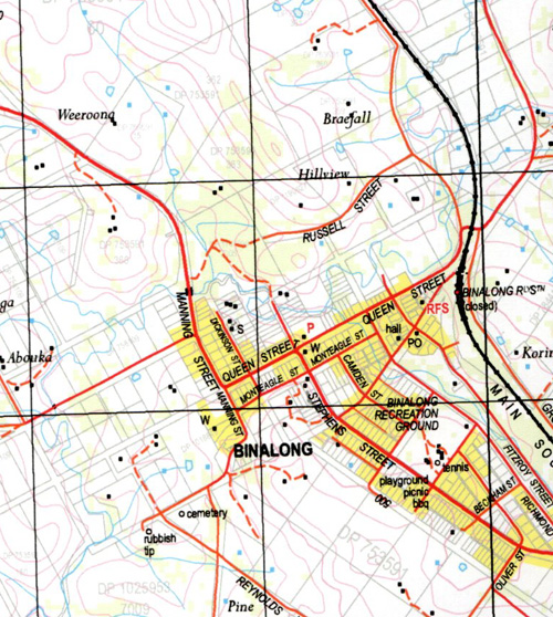
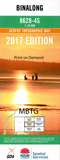
Binalong 1-25,000 NSW Topographic Map
Price range: $16.95 through $31.95
Description:
8628-4-S Print on Demand
Binalong 86284s 1-25,000 Scale NSW Topographical Map is usedfor Walking, 4WD, Fishing, Camping, Motorcycle, both On and Off Road, GoldProspecting and for those simply going for a family weekend drive.
Topographicalmaps show not only Contours of the Terrain but also Walking Tracks, Sealed andUnsealed Roads, Rivers, Creeks, Lakes, Historical Point of Interest, Old MineSites and National and State Park areas.
 Laminate and folded this NSW Topographical map, $12.00 see below.
This map includes the following localities: Binalong Back Creek Balgalal Creek Bangalal Creek Bobbara Gully Mount Bobbara Bobbara Bobbara Creek Bobbara Flat Creek Binalong Public School Binalong Railway Station Binalong Post Office Binalong Cemetery Coppabella Coppabella Hills Dunderalligo Creek Dwyers Creek Goondah Goondah Railway Station Harden Heafeys Hill Illalong Illalong Creek Jerusalem Hill Cumbamurra Creek Cumbamurra River Cuppabella General Cemetery Illalong Creek Railway Station Kileys Hill Little Bobbara Mountain Hill Mylora Pine Hills Creek Sheep Station Creek Stony Creek Two Mile Creek Bullock Hill Bungalal Creek Bushrangers Hill Chinamans Creek
| Scale: | 1:25000 |
| Latitude Range: | 34 37.5 S – 34 45.0 S |
| Longitude Range: | 148 30.0 E – 148 45.0 E |
| Approx Print Size: | 0.56m X 1.11m |
| Projection: | Transverse Mercator |