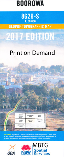
Boorowa 1-50000 NSW Topographic Map
$16.95 – $31.95
Description:
Boorowa 8629-S 1-50,000 scale NSW Topographical map is used for Walking, 4WD, Fishing, Camping, Motorcycle, both On and Off Road, Gold Prospecting and for those simply going for a family weekend drive.
Topographical maps show not only Contours of the Terrain but also Walking Tracks, Sealed and Unsealed Roads, Rivers, Creeks, Lakes, Historical Point of Interest, Old Mine Sites and National and State Park areas.
 We can Now LAMINATE and fold your map for $12.00. Just click on the image and add to the Trolley
NOW AVAILABLE PRINT ON DEMAND
Locations within this Map
Spring Valley Dorroughby Tyrone Omach Eurimba Forest Lodge Ballyhooley Claremont Gairloch Khanyunnig Wiruna Hazeldean The Range Narrallen Avonleigh Roaring Rock Balbardie Tara Fairview Glenton Villa Cains Cobra Kyeema Little Kyba Stud Gentle Destiny Bolong Boona Forestdene Doonside Pine Hills Annalee Bellview Amerton Little Plains Westerways Lugarno Red Bank Shalimar Geegullaleng Limerlost Suffolk Vale Gunnary Vale Trenayr Dunmore Noongah Alexander Heathfield Louvain Allendale Langley Crossroads Wantana Willawong Killanear Mount View Oak Hill Willowmere Glenina Tamale Bangalore Hillgrove Glenmore Caramba Mimosa Rockview Hanaminno Kawhia Macclesfield Strathmore Hillrose Iona Summerdale Tiwarrie Beltana Boorowa Back Creek Anns Vale Bala Barnett Barnett Hill Bees Nest Creek Bees Nest Gully Big Canemumbola Big Canemumbola Hill Big Carramumbola Hill Black Range Boorowa Cemetery Boorowa Central School Boorowa Post Office Boorowa Public School Boorowa Railway Station Boorowa River Box Hill Boyles Creek Boyles Gully Bramah Creek Branch of Walla Walla Creek Cades Creek Carramumbola castles Creek Cockatoo Hill Congera Congera Hill Corcorans Creek Cusack Davy Creek Fell Timber Creek Fishers Creek Five Mile Creek Frogmore Frogmore Creek Frogmore Public School Frogs Hole Frogs Hole Creek Geegullalong Geegullalong Creek Mount Geegullalong Goba Creek Gooramma Gorham Creek Grove Gungewalla Gunnary Gunnary Creek Harry Darts Creek Harrys Creek High Hill High Hill Creek Honeysuckle Hill Kennys Creek Calabash Canemumbola Cattle Station Branch Davys Creek Fishers Branch Creek Geegullalong or Castles Creek Gooramma Railway Station Gungewalla Creek Kangaroo Micks Kenneys Creek Licking Hole Creek Licking Hole Gully Limestone Creek Little Canemumbola Little Canemumbola Hill Little Carramumbola Hill Little Creek Little Plains Creek Lyons Mcbriens Creek Medway Creek Mick Mahons Creek Mountain Creek Murdering Creek Murringo Murringo Cemetery Murringo General Cemetery Murringo Public School Murrungal Murrungal Hill Native Dog Creek Nurung Phils Creek Pipeclay Creek Playboy Hill Pudman Pudman Creek Pudmans Creek Racecourse Creek Reedy Creek Rugby Ryans Creek Saltwater Creek Saltwater Hill Sawpit Flat Shanty Creek Smelleys Lagoon Spring Creek Springy Flat Creek Stoney Creek Stony Creek Stringybark Flat Suffolk Walla Walla Creek Ware Waterhole Flat Creek Water Hole Flat Water-Hole-Flat Creek White Rock Creek Willawong Creek Willawong Falls Willawong Ridge Woolshed Creek Yellow Waterhole Creek Douglas Douglas Gap Douglas Range Burrowa Dirt Hole Creek Hardiman Creek Gungewalla Nature Reserve The Ranch Congerah Hill The Pine Hill The Little Creek Campbellfields Fishers Branch Kyeemagh Nilgari Goorama
| Name: | Boorowa |
| Publisher: | New South Wales Government |
| Scale: | 1:50000 |
| Latitude Range: | 34° 15.0′ S – 34° 30.0′ S |
| Longitude Range: | 148° 30.0′ E – 149° 0.0′ E |
| Datum: | GDA 94 |


