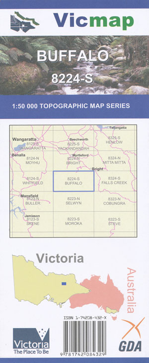
Buffalo 1-50,000 Vicmap
Price range: $12.00 through $24.00
Description:
Buffalo 1-50,000 scale Vicmap Topographical map 8224S is used for Walking, 4WD, Fishing, Camping, Motorcycle, both On and Off Road, Gold Prospecting and for those simply going for a family weekend drive.
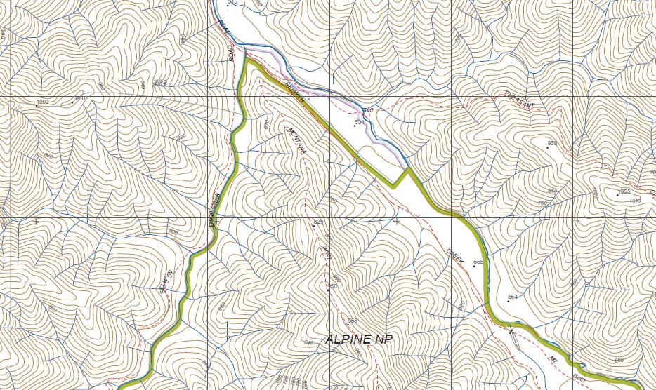
Topographical maps show not only Contours of the Terrain but Walking Tracks, Sealed and Unsealed Roads, Rivers, Creeks, Lakes, Historical Point of Interest, Old Mine Sites mbtg and National and State Park areas.
Main Features of this map includes:
Abbeyard, Dandongadale, Wandillagong, The Southern section of the Buffalo National Park,, Mount Buffalo National Park, Wandiligong, Dunphys Hill, Buckland, Buckland Junction, Buckland State Park Buckland River, mbtg Mount Mary, The Valley of the Gods, The Tombstones, The Horn, The Castle, The Hump, Buffalo Plateau, The Rocks Saddle, Yarrarabula Remote and Natural Area, YARRABUCK TRACK, LE SOUEF PEAK, THE WHALE ROCK, MAHOMETS COFFIN, Brookside, mbtg, Devils Creek Bridge, Buckland Bridge, LYREBIRD PEAK, Devils Ck – Middle Branch Natural Catchment Area, Salt Log, Eagle Peak, Morning Star Mine (Disused), Buckland Junction, Annie River, Yarrarabula Creek Natural Catchment Area, Dandongadale (part in Alpine NP) Remote and Natural Area, Paddy Hill, Buffalo Range, Paddy Hill Track, Albion Point
Dandongadale, Rose Rivedr, Gentle Annie Gap, Patrol Track, Matong North Plantation, Mount Pleasant Reference Area (no public access), Winteriga Plantation, Cropper Creek North Branch, Cropper Gap, Dandongadale Buffalo Divide Track, southern section of Lake Buffalo, Rocky Creek Hike-In Camping, Rocky Creek Falls, Yarrarabula Remote and Natural Area, Abbeyard, Mount Typo, Mount McIver, Mount Warrick, Buffalo River, Rose River, Bennies Camping Area, mbtg, Wild Horse Gap, Matong North Plantation, Ant Hill Saddle, Markous, Mount Jasper, Wild Horse Gap, Possum Point, Mccready Corner, Long Jack Creek Natural Catchment Area, Dandongadale (part in State Forest) Remote and Natural Area, Dandongadale (part in Alpine NP) Remote and Natural Area, Mount Angus, Mount Buggery, Catherine River Track
ISBN 9781742084329
You may also like…
-
Dandongadale South 1-25,000 Vicmap Topo 8224-3-S
Price range: $14.00 through $26.00Select options This product has multiple variants. The options may be chosen on the product page -
Falls Creek 1-50,000 Vicmap Topographic Map 8324-S
Price range: $14.00 through $26.00Select options This product has multiple variants. The options may be chosen on the product page -
BRIGHT SOUTH 1-25,000 Vicmap Topo Map 8224-1-S
Price range: $14.00 through $26.00Select options This product has multiple variants. The options may be chosen on the product page -
Mount Buffalo Map Spatial Vision
Price range: $19.85 through $28.95Select options This product has multiple variants. The options may be chosen on the product page -
Selwyn 1-50,000 Vicmap
Price range: $12.00 through $24.00Select options This product has multiple variants. The options may be chosen on the product page -
Buller 1-50,000 Vicmap
Price range: $12.00 through $24.00Select options This product has multiple variants. The options may be chosen on the product page -
Bright 1-50,000 Vicmap
Price range: $12.00 through $24.00Select options This product has multiple variants. The options may be chosen on the product page