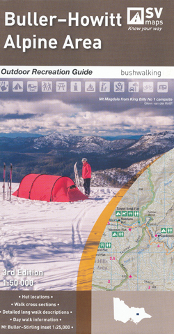
Buller Howitt Alpine Area Map Spatial Vision
Price range: $19.95 through $29.95
Description:
Buller Howitt Alpine Area Map Spatial Vision
Now Print on Demand 2 Sided Map and Text
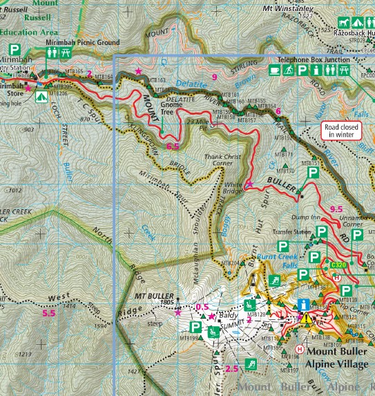
The Buller-Howitt Alpine Area recreation guide has visitor information regarding overnight hiking, walking tracks, major activities, car and four wheel touring as well as flora and fauna.
Special Features include:
Mt Buller Resort Mt Stirling Mt Howitt The Vikings Howitt Plain Bryces Plain The Bluff The Razorback Mt Magdala King Billy 1&2 Cobbler Plain Pineapple Flat Mt Buggery Howqua Hills Crosscut Saw Sheepyard Flat, Mt Speculation, Mt Dispair, Bindaree Hut, Bluff HBut, Bluff Hut Spur, Boggy Creek Hut, Buttercup Creek No 2 No 3 No 4, Carters Road Camping Area, Chesters Yard, Circuit Road Picnic Area, Cobbler Lake Hut, Craigs Hut, Cricket Pitch Hut, Davons Flat, Eight Mile Flat, Gardiners Hut, mbtg, Geelong Grammar School Hut, Guts Hut, Howitt Hut, Howitt Plains Carpark, Howqua Gap Hut, Lovicks Hut, Mitchells, Noonans Flat and Hut, Pickerings Flat and Hut, Pikes Flat, Pineapple Flat, Razorback Hut, Refridgerator Gap Hut, Ritchies Hut, Seven Mile Flat, Sheepyard Flat, Telephone Box Junction, Tomohawk Hut, Upper Howqua Camping Area, Upper Jamieson Hut, Vallejo Gardner Hut, Wonnangatta Station on the far right edge of the map
- Colour topographic map at 1:50,000 scale
- Overnight hiking routes and campsites
- Selected walking track cross sections indicating slope and difficulty
- Major recreational facilities, huts, parks and forests
- GPS co-ordinates of campsites and huts
- Historical information and photographs
SCALE: 1:50,000
COVERAGE: Mt Buller, Mt Stirling, Mt Howitt, Wonnangatta Station Sheepyard Flat
IDEAL FOR: Bushwalking, Cross-country skiing, mountain biking and car touring
EDITION: 1
SIZE (folded):135mm wide and 250mm high
SIZE (unfolded): 1000mm wide by 675mm high
ISBN 9780648337621
You may also like…
-
Buller 1-50,000 Vicmap
Price range: $12.00 through $24.00Select options This product has multiple variants. The options may be chosen on the product page -
Buller North 1-25,000 Vicmap Topographic Map 8123-1-N
Price range: $14.00 through $26.00Select options This product has multiple variants. The options may be chosen on the product page -
Mansfield Mt Howitt Map Rooftop
Price range: $8.95 through $17.00Select options This product has multiple variants. The options may be chosen on the product page -
Buller Howitt Alpine Area Map Spatial Vision FLAT
Price range: $16.95 through $28.95Select options This product has multiple variants. The options may be chosen on the product page -
BULLER SOUTH 1-25,000 Vicmap Topo Map 8123-1-S
Price range: $14.00 through $26.00Select options This product has multiple variants. The options may be chosen on the product page