Burragorang 1-25,000 NSW Topographic Map
$16.95 – $31.95
Description:
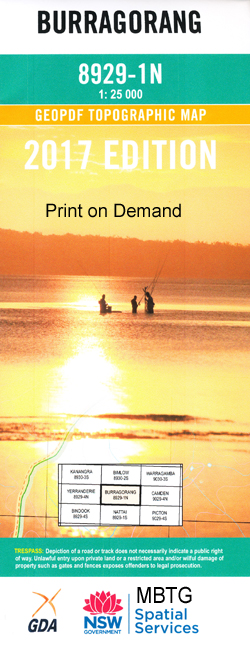
8929-1-N Print on Demand
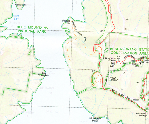
Burragorang 1-25,000 Scale NSW Topographical Map is usedfor Walking, 4WD, Fishing, Camping, Motorcycle, both On and Off Road, GoldProspecting and for those simply going for a family weekend drive.
Topographicalmaps show not only Contours of the Terrain but also Walking Tracks, Sealed andUnsealed Roads, Rivers, Creeks, Lakes, Historical Point of Interest, Old MineSites and National and State Park areas.
 Laminate and folded this NSW Topographical map $12.00 see below.
This map includes the following localities: Aroona Barkers Canyon Barkers Creek Barrons Corner Bob Higgins Creek The Bluff Blue Breaks Blossom Lodge Blossom Lodge Flat Blossom Lodge Gully Bimlow Walls Bimlow Tableland Braithwaite Lookout Brimstone Creek Brimstone Gully Brimstone Point Broken Rock Point Carlon Point Chiddy Point Clump Hill Head Clump Point Dunns Gully Flynns Lookout Gillans Creek Gorman Gully Mount Gorman Gorman Point Green Wattle Creek Green Wattle Mountain Green Wattle Saddle Hayes Point Higgins Bay Mount Hoggett Irish Bay Jerry O’Leary Point Mount Kamilaroi Kamilaroi Point Deep Creek Green Wattle Break Higgins Creek Kooloo Creek Lacys Creek Lacys Creek North Canyon Lacys Creek South Canyon Lacys Gap Lacys Head Lacys Tableland Little Cedar Creek Lowest Water Creek March Creek Maxwells Broken Rock Murrungurry Point Mount Murrungurry Nattai Nattai Post Office Nattai River Nattai River Post Office The Prow Reilly Creek Snake Mountains South Tonalli Walls Spring Creek Terni The Peaks Tonalli Cove Tonalli Pass Tonalli Peak Tonalli Range Tonalli River Tonalli River Arm Tonalli Tableland Tonalli Walls Toppleover Peak Tumbledown Mountain Tumbledown Ridge Wingecarribee Woodville Point Dinner Creek Bull Island Gap Ditton Dog Tree Creek Burragorang Burragorang Lookout Burragorang Peak Burragorang Tableland Butchers Shop Creek Davis Creek Rangers Creek Yerranderie State Conservation Area Burragorang State Conservation Area Nattai State Conservation Area Broken Rock Davies Snake Toppleover Tumbledown Houlouhan Point
| Scale: | 1:25000 |
| Latitude Range: | 34 00.0 S – 34 07.5 S |
| Longitude Range: | 150 15.0 E – 150 30.0 E |
| Approx Print Size: | 0.56m X 1.11m |
| Projection: | Transverse Mercator |


