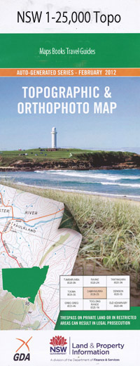
Byron Bay 1-25,000 NSW Topographic Map
Price range: $16.95 through $31.95
Description:
9640-4-S
Byron Bay 1-25,000 Scale NSW Topographical Map is usedfor Walking, 4WD, Fishing, Camping, Motorcycle, both On and Off Road, GoldProspecting and for those simply going for a family weekend drive.
Topographicalmaps show not only Contours of the Terrain but also Walking Tracks, Sealed andUnsealed Roads, Rivers, Creeks, Lakes, Historical Point of Interest, Old MineSites and National and State Park areas.
 Laminate and folded this NSW Topographical map $12.00 see below.
This map includes the following localities: Fairview Bangalow Byron Bay Suffolk Park Bandongrove Creek Bangalow Dip Bangalow Park Bangalow Post Office Bangalow Public School Bangalow Railway Station Bauers Lane Dip Belongil Lagoon Brays Beach Brays Hole Brays Waterhole Broken Head Broken Head Beach Broken Head Public School Brooklet Brooklet Dip Cape Byron Cape Byron Lighthouse Cape Byron Nature Reserve Captain Cook Lookout Clarkes Beach Cocked Hat Rock Coopers Shoot Coopers Shoot Dip Coorabell Cosy Corner Cumbebin Swamp Ewingsdale Ewingsdale Public School Fishermans Lookout Flicks Dip Gaggin Park Granuaille Harts Dip Hayters Hill Dip Hayters Hill Hogans Bluff Jarretts Dip Jews Point Clarks Beach Coorabell Creek The Gap Hayter Hill Kings Beach Kings Rock Little Beach Little Wategos Beach McLeods Shoot Main Coast Range Maori Creek Midgen Dip Midgum Dip Midgen Creek Midgen Flat Midgum Creek Mignon Flat Morans Hill Newrybar Newrybar Public School Newrybar Swamp Opossum Creek Paddymelon Gully Paddymellon Creek Paddys Creek Palm Valley Piccadilly Dip Piccadilly Hill St Helena St Helena Dip St Helena Railway Station Rankins Dip Razorback Rifle Range Dip Schnapper Rock Seven Mile Beach Shell Dip Skinners Creek Dip Skinners Creek Skinners Shoot Skinners Shoot Dip Sleepy Creek Snapper Rock Suffolk Park Dip Tabletop Tallow Beach Tallow Creek Talofa Talofa Railway Station Tinderbox Creek Titree Creek Tyagarah Creek Wategos Beach Wategos Gap Watson Lane Dip Whites Beach Willowvale Creek Zircon Dip Zone Dip Donnollys Dip Dudgeons Dip Byron Byron Bay Dip Byron Bay General Cemetery Byron Bay High School Byron Bay Post Office Byron Bay Lighthouse Byron Bay Public School Byron Bay Railway Station Byron Creek Byron View Hayter Hayters Hill Nature Reserve Belongil Creek Eric Wright Lookout The Pass Main Beach Midgen Environment Park Sunrise Park Wategos The Wreck
| Scale: | 1:25000 |
| Latitude Range: | 28 37.5 S – 28 45.0 S |
| Longitude Range: | 153 30.0 E – 153 45.0 E |
| Approx Print Size: | 0.56m X 1.11m |
| Projection: | Transverse Mercator |