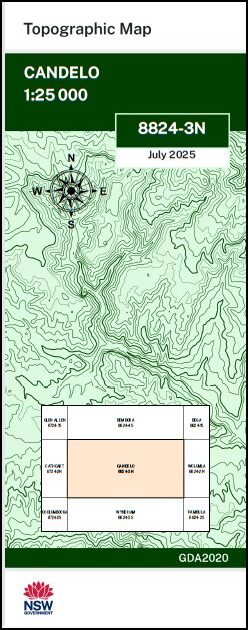
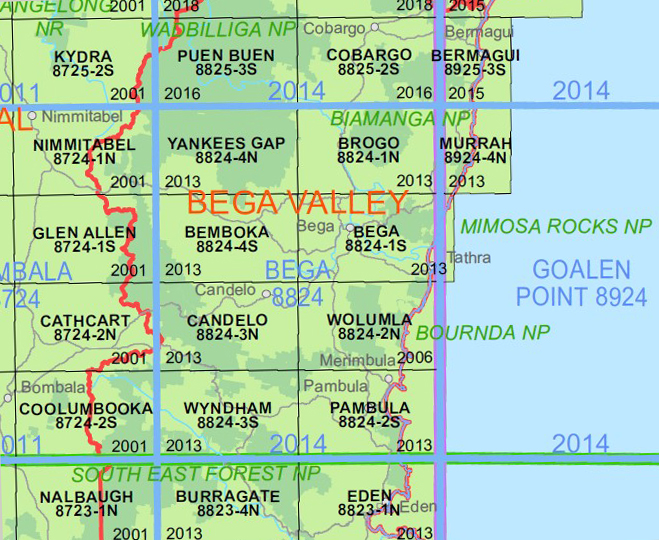
Candelo 1-25,000 NSW Topographic Map 8824-3-N
Price range: $16.95 through $29.95
Description:
Candelo 1-25,000 NSW Topographic Map 8824-3-N PRINT ON DEMAND is used for Walking, 4WD, Fishing, Camping, Motorcycle, both On and Off Road, Gold Prospecting and for those simply going for a family weekend drive.
Topographical maps show not only Contours of the Terrain but also Walking Tracks, Sealed and Unsealed Roads, Rivers, Creeks, Lakes, Historical Point of Interest, Old Mine Sites mbtg and National and State Park areas.
Locations within this Map
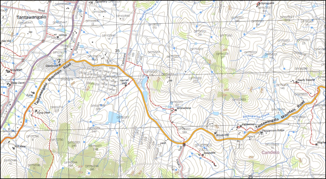
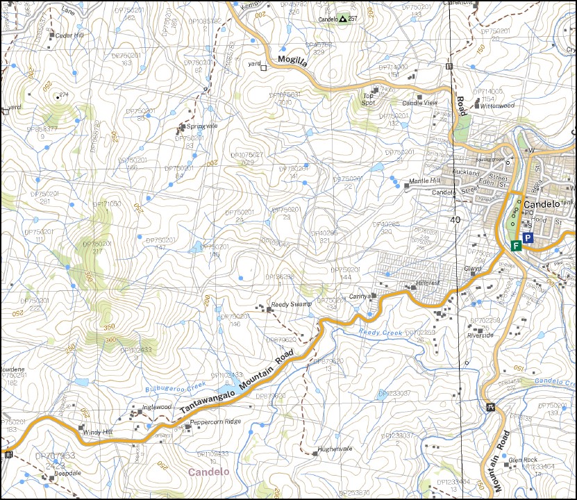
Candelo Auckland Bateman Creek Mount Bobendoura Black Log Creek Bredbendoura Candelo Public School Devils Creek Hains Creek Mount Harriet Devils or Mccarthys Creek Knoxs Valley Mccarthys Creek Mount Darragh Myrtle Mountain Myrtle Mountain Lookout Reedy Creek Reedy Swamp Rocky Waterhole Running Creek Ryan Swamp Six Mile Creek Tantawangalo Tantawangalo Lookout Tantawangalo Mountain Two Bridges Creek Wolumla Wolumla Creek Wolumla Peak Yurammie Yurammie State Forest Batemans Creek Blue Gate Creek Bulbugaroo Creek Candelo Creek Goldens Creek Mookalimberria Creek Musky Creek Plums Creek Towridgee Creek Myrtle Mountain Flora Reserve mbtg Tantawangalo Creek Flora Reserve Kameruka Tantawanglo Toothdale Wolumla South Massey Peak
| Scale: | 1:25,000 |
| Latitude Range: | 36° 45.0′ S – 36° 52.5′ S |
| Longitude Range: | 149° 30.0′ E – 149° 45.0′ E |
| Datum: | GDA 2020 |
| Approx Print Size: | 0.56m X 1.11m |
| Publication Date: |
Edition 2025 |
You may also like…
-
Merimbula Bermagui Adventure Map Rooftop
Price range: $12.95 through $25.00Select options This product has multiple variants. The options may be chosen on the product page -
South Coast New South Wales Flat Map
Price range: $15.95 through $27.95Select options This product has multiple variants. The options may be chosen on the product page -
Bemboka 1-25,000 NSW Topographic Map 8824-4-S
Price range: $16.95 through $28.95Select options This product has multiple variants. The options may be chosen on the product page -
Far South Coast Map NSW Forestry Folded and Flat
Price range: $14.00 through $26.00Select options This product has multiple variants. The options may be chosen on the product page -
Brogo 1-25,000 NSW Topographic Map 8824-1-N
Price range: $16.95 through $29.95Select options This product has multiple variants. The options may be chosen on the product page -
Bega 1-25,000 NSW Topographic Map 8824-1-S
Price range: $16.95 through $29.95Select options This product has multiple variants. The options may be chosen on the product page