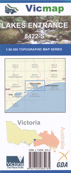
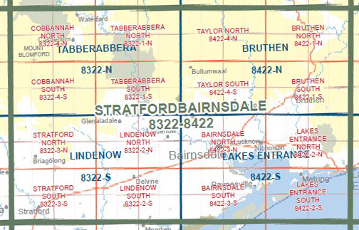
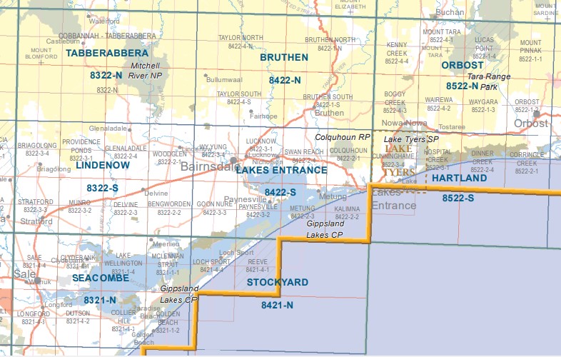
Lakes Entrance 1-50,000 Vicmap
Price range: $12.00 through $24.00
Description:
Part of the Wilderness Coast Walk
Lakes Entrance 1-50,000 scale Victorian Topographical map 8422S is used for Walking, 4WD, Fishing, Camping, Motorcycle, both On and Off Road, Gold Prospecting and for those simply going for a family weekend drive.
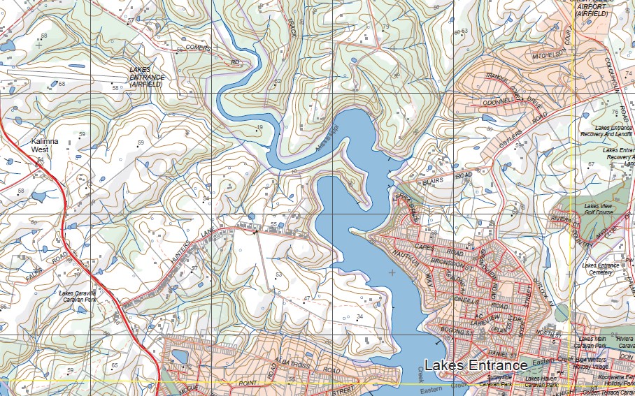
Topographical maps show not only Contours of the Terrain but Walking Tracks, Sealed and Unsealed Roads, Rivers, Creeks, Lakes, Historical Point of Interest, Old Mine Sites mbtg and both National and State Park areas.
Main Features of this map includes:
Part of the East Gippsland Rail Trail
Western Part of Lakes Entrace, Johnsonville, Nicholson River, Tambo River, Lakes Bushland Caravan Park, Claybank, SLAUGHTERHOUSE CREEK GLR, Part of Lake King, Bumberrah, Tambo Upper, Colquhoun Boyanga Gidi State Forest, Swan Reach, COLQUHOUN RP, NYERIMILANG PARK GLR, BANCROFT BAY KALIMNA GLR, mbtg, Metung, Kalimna, Part of Raymond Island, Waddy Island, Ocean Grange, part of Lake Victoria, Gannet Campground, Pelican Campground, Shearwater Campground, Egret Campground, Albatross Campground, Cormorant Campground, Dotterel Campground, Flannagan Island, Nyerimilang, Nungurner, MOUNT BARKLY, Rigby Island
Bairnsdale, Mitchell River, Wy Yung, Lucknow, part of Lake King, Nicholson and the Nicholson River, Angus Mcmillan Monument, Calulu, Hillside, Mount Lookout, Sarsfield, Paynesville, Goon Nure, MOORMURNG FFR, BLOND BAY WR, MACLEOD MORASS WR, Tannin Point, STEEL BAY NEWLAND BACKWATER GLR, Lake Reeve, MITCHELL RIVER SILT JETTIES GLR, Southern section of Raymond Island
ISBN 9781742085135
You may also like…
-
Mallacoota 1-50,000 Vicmap Topographic Map 8822-N
Price range: $14.00 through $26.00Select options This product has multiple variants. The options may be chosen on the product page -
Hartland 1-50,000 Vicmap
Price range: $12.00 through $24.00Select options This product has multiple variants. The options may be chosen on the product page -
Stockyard 1-50,000 Vicmap
Price range: $12.00 through $24.00Select options This product has multiple variants. The options may be chosen on the product page -
Everard 1-50,000 Vicmap
Price range: $12.00 through $24.00Select options This product has multiple variants. The options may be chosen on the product page -
Gippsland Lakes Outdoor Map Spatial Vision
Price range: $16.95 through $28.95Select options This product has multiple variants. The options may be chosen on the product page -
Bemm 1-50,000 Vicmap
Price range: $12.00 through $24.00Select options This product has multiple variants. The options may be chosen on the product page -
Seacombe 1-50,000 Vicmap
Price range: $12.00 through $24.00Select options This product has multiple variants. The options may be chosen on the product page