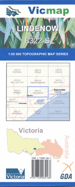
Lindenow 1-50,000 Vicmap
Price range: $12.00 through $24.00
Description:
Lindenow 1-50,000 scale Vicmap Topographical map 8322S is used for Walking, 4WD, Fishing, Camping, Motorcycle, both On and Off Road, Gold Prospecting and for those simply going for a family weekend drive.
Topographical maps show not only Contours of the Terrain but Walking Tracks, Sealed and Unsealed Roads, Rivers, Creeks, Lakes, Historical Points of Interest, Old Mine Sites mbtg and National and State Park areas.
Main Features of this map includes:
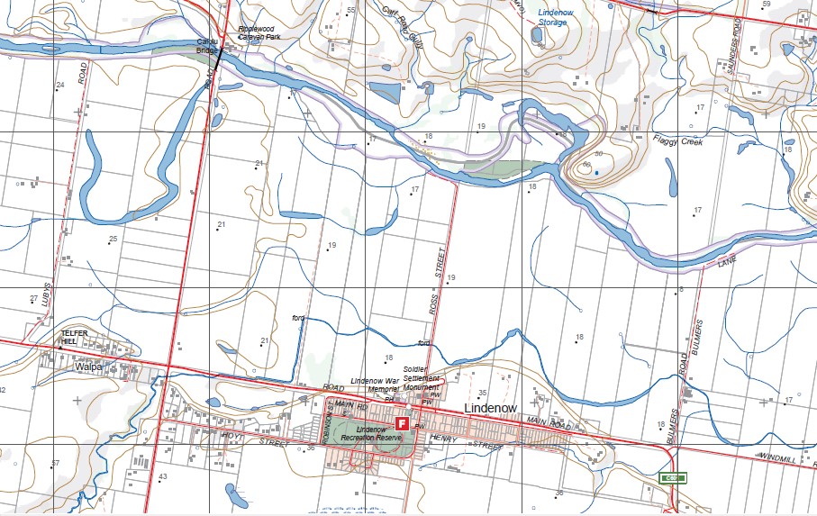
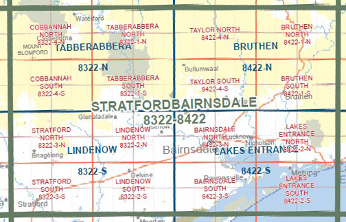
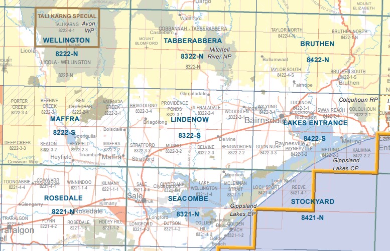
Briagalong, Stratford, Lindenow towns, Mitchell River, Avon River. Providence Ponds, Fernbank and Glenaladale
Briagolong, Valencia Creek and State Park, Bushy Park, GEORGE CREEK SSR, The Quaries, Moornapa State Forest, Cullode, Bow – Worrung State Forest, Stockdale, MOUNT MOORNAPA FR, Calajero State Forest, Delwp Plantation, Stockdale State Forest, Avon River, mbtg, Stratford, Munro, Llowalong, mbtg, Princes Highway, Blackall Creek, STRATFORD HP, The Knob Recreational Reserve, SWALLOW LAGOON NCR, YEERUNG BR, Aird Morass
Lindenow, Glenaladale, Limpyers State Forest, PROVIDENCE PONDS FFR, Fernbank, The Fingerboards, Mitchell River National Park and River, Coongulmerang, Woodglen, Wuk Wuk, Ripplewood Caravan Park, Calulu Bridge, Angus Mcmillan Monument, Flaggy Creek, mbtg, Bengworden, PROVIDENCE PONDS FFR, Tom Creek Bridge, BACKWATER MORASS GLR, MOORMURNG FFR, BENGWORDEN NCR, Deighton Creek
ISBN 9781742085166
You may also like…
-
Seacombe 1-50,000 Vicmap
Price range: $12.00 through $24.00Select options This product has multiple variants. The options may be chosen on the product page -
Maffra 1-50,000 Vicmap
Price range: $12.00 through $24.00Select options This product has multiple variants. The options may be chosen on the product page -
STRATFORD SOUTH 1-25,000 Vicmap Topo Map 8322-3-S
Price range: $14.00 through $26.00Select options This product has multiple variants. The options may be chosen on the product page -
Stockyard 1-50,000 Vicmap
Price range: $12.00 through $24.00Select options This product has multiple variants. The options may be chosen on the product page -
STRATFORD NORTH 1-25,000 Vicmap Topo Map 8322-3-N
Price range: $14.00 through $26.00Select options This product has multiple variants. The options may be chosen on the product page -
Bruthen 1-50,000 Vicmap
Price range: $12.00 through $24.00Select options This product has multiple variants. The options may be chosen on the product page -
Lakes Entrance 1-50,000 Vicmap
Price range: $12.00 through $24.00Select options This product has multiple variants. The options may be chosen on the product page -
Rosedale 1-50,000 Vicmap
Price range: $12.00 through $24.00Select options This product has multiple variants. The options may be chosen on the product page