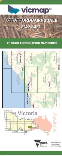
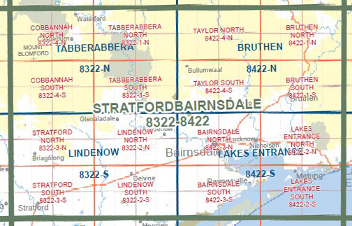
STRATFORD BAIRNSDALE 1-100,000 Vicmap 8322-8422
$14.00
Description:
STRATFORD BAIRNSDALE 1-100,000 Vicmap 8322-8422 NOW PRINT ON DEMAND is used for Walking, 4WD, Fishing, Camping, Motorcycle, both On and Off Road, Gold Prospecting and for those simply going for a family weekend drive.
This is a new series of 1-100,000 scale maps, all of Victoria is covered by these maps.
Topographical maps show not only Contours of the Terrain but Walking Tracks, Sealed and Unsealed Roads, Rivers, Creeks, Lakes, Historical Points of Interest, Old Mine Sites and National and State Park areas.
Main Features of this map includes:
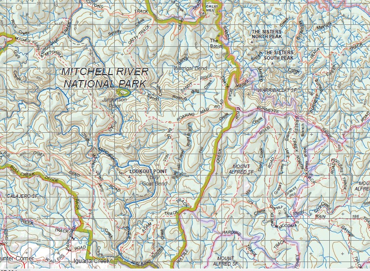
Bairnsdale, Stratford, Waterford, Mount Thomson, MOUNT DJOANDAH, Tabberabbera, Punchen Creek Natural Catchment Area, Woolly Butt Spur, Mount Hoad, Mount Sugarloaf, Mount Welcome, The Snakes Back, Tambo Crossing, Mount Elizabeth, SPANKER KNOB, Red Knob, Double Bridges, Deptford, Bullumwaal, MITCHELL RIVER NATIONAL PARK, Angusvale, MOUNT BUDGEE BUDGEE, Castleburn, Blomford, Cobbannah, Davey Knob, Yellowman Knob, Mount Alfred, Boggy Creek, Mount Little Dick, Ramrod Creek, Bruthen, Mossiface, Sarsfield, Fairhope, Mount Taylor, Mount Ray, Valencia Creek, Lindenow, Wy Yung, Lucknow, Tambo Upper, Swan Reach, Johnsonville, COLQUHOUN RP, Lake Entrance, Cunninghame, Kalimna West, Nungurner, Nicholson, Lake King, Fernbank, Providence Ponds, Briagolong, Boisdale, Maffra, Munro, Paynesville, Lake Victoria, Metung, Bengworden, Goon Nure, Meerlieu, Ocean Grange
You may also like…
-
Lindenow 1-50,000 Vicmap
Price range: $12.00 through $24.00Select options This product has multiple variants. The options may be chosen on the product page -
Lakes Entrance 1-50,000 Vicmap
Price range: $12.00 through $24.00Select options This product has multiple variants. The options may be chosen on the product page -
Bruthen 1-50,000 Vicmap
Price range: $12.00 through $24.00Select options This product has multiple variants. The options may be chosen on the product page -
Gippsland Lakes Outdoor Map Spatial Vision
Price range: $16.95 through $28.95Select options This product has multiple variants. The options may be chosen on the product page -
Tabberabbera 1-50,000 Vicmap
Price range: $12.00 through $24.00Select options This product has multiple variants. The options may be chosen on the product page