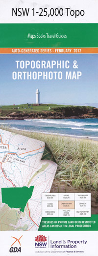
Catherine Hill Bay 1-25,000 NSW Topographic Map
$16.95 – $31.95
Description:
9231-4-S
Catherine Hill Bay 1-25,000 Scale NSW Topographical Map is usedfor Walking, 4WD, Fishing, Camping, Motorcycle, both On and Off Road, GoldProspecting and for those simply going for a family weekend drive.
Topographicalmaps show not only Contours of the Terrain but also Walking Tracks, Sealed andUnsealed Roads, Rivers, Creeks, Lakes, Historical Point of Interest, Old MineSites and National and State Park areas.
 Laminate and folded this NSW Topographical map, $12.00 see below
This map includes the following localities: Barbarossa Chain Valley Bay Budgewoi Gwandalan Lake Munmorah Mannering Park Nords Wharf Wyee Point Baldy Baldy Cliff Baxter Park Big Bumpy Blue Haven Black Neds Point The Blowhole Bird Island Bird Island Creek Bird Island Nature Reserve Birdie Beach Birdie Creek Bird Cage Point Bogey Hole Bongan Bongon Bongon Beach Bongon Head Bongon Lagoon Bonny Boy Creek Bonny Boy Gully Browns Point Budgewoi Creek Budgewoi Lake Budgewoi Point Budgewoi Public School Buff Point Cams Point Cams Wharf Catherine Hill Bay Catherine Hill Bay Public School Charmhaven Clarence Street Reserve Cobra Creek Colongra Creek Colongra Lake Colongra Point Colongra Swamp Crangan Bay Crangan Creek Deadmans Beach Deep Cave Bay Desoto Inlet Elizabeth Bay Flat Island Flat Rocks Point Frazer Beach Frazer Blowhole Frazer Inlet Frazer Park Freemans Park Frying Pan Bay Frying Pan Point Geebung Goobarabah Point Gorokan High School Gorokan Park Gorokan Public School Green Point Groper Hole Gwandalan Public School Hammond Canal Hargraves Beach Hendersons Point Hillary Park Howard Reserve James Vale Park Karignan Creek Chain Valley Creek Desoto Gulf Flat Rocks Fraser Park Goobarabah The Gorge Gorokan Community Park The Gulf Halekulani Halekulani Public School Hammond Creek The Hole Inderan Kingfisher Reserve Lake Munmorah Public School Lakes Beach Lakeside Little Beach Little Birdie Beach Little Bumpy Mackenzie Reserve Mandalong Mandalong Point Mangrove Creek Mangrove Gully Mannering Bay Mannering Inlet Mannering Lake Mannering Park Sportsground Mannering Park Public School Mannering Point Middle Camp Middle Camp Beach Middle Camp Creek Middle Camp Gully Middle Camp Inlet Mine Camp Moonee Beach Mooney Point Moon Island Beach Munmorah Lake Munmorah Lake Public School Munmorah Sportsground Munmorah State Conservation Area Nords Wharf Public School Ocowolrolong Ocowolrolong Point Orooaloo Orooaloo Point Ourringo Ourringo Point Pallamanaba Creek Pinny Beach Pipeclay Creek Podgewoy Reserve Red Ochre Beach Sand Bluff Sandy Beach San Remo Second Creek Shark Hole Slade Park Snapper Point South Beach South Beach Estate South Beach Reserve South Beach Wharf Stranger Gully The Stranger Summerland Point Summerland Point Reserve Swampy Creek Taylor Point The Palms Tiembula Creek Timber Beach Tunkuwallin Park Vales Point Vales Point Park Wallarah Wallarah Creek Wallarah Creek Park Wybung Wybung Head Wyee Bay Wyee Creek Wyee Wharf Diamond Drill Point Yellow Rock Doyalson Drummer Hole Budgewoi Beach Charmhaven Park Deep Cave Mcculloch Reserve Parkside Reserve Chain Valley Bay Reserve Gathercole Park Budgewoi Peninsula Doyalson North Point Wolstoncroft Moonee Waterfall Beach Gravelly Beach Coral Fern Beach Ghosties Beach Birdie Lagoon Lake Haven Colongra Rayment Park Freemans Northlakes Public School The Tom Barney Oval Maddison Reserve Edgewater Park Bears Creek Pat Slaven Reserve Gwandalan Lions Park Tom Burke Reserve Middle Camp New Munmorah Gwandalan Lioness Park Kingfisher Shores Joshua Porter Reserve Hales Bluff Lions Park
| Scale: | 1:25000 |
| Latitude Range: | 33 07.5 S – 33 15.0 S |
| Longitude Range: | 151 30.0 E – 151 45.0 E |
| Approx Print Size: | 0.56m X 1.11m |
| Projection: | Transverse Mercator |

