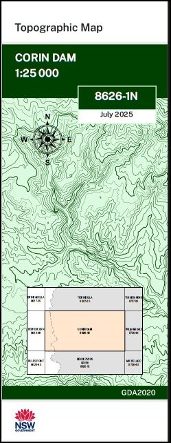

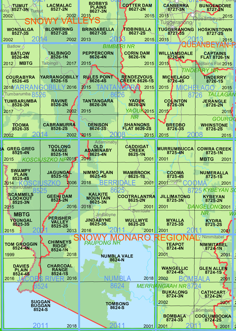
Corin Dam 1-25,000 NSW Topographic Map 8626-1-N
Price range: $16.95 through $29.95
Description:
Corin Dam 1-25,000 NSW Topographic Map 8626-1-N Now Print on Demand is used for Walking, 4WD, Fishing, Camping, Motorcycle, both On and Off Road, Gold Prospecting and for those simply going for a family weekend drive.
Topographical maps show not only Contours of the Terrain but also Walking Tracks, Sealed and Unsealed Roads, Rivers, Creeks, Lakes, Historical Point of Interest, Old Mine Sites mbtg and National and State Park areas.
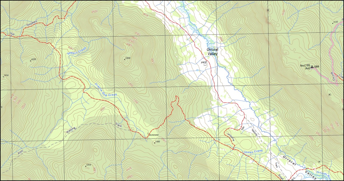
This map includes the following localities: AAWT Blackfellows Gap Blackfellows Creek Bimberi Brumbys Flats Mount Gingera Mount Ginini Harrys Spur Little Ginini Mountain Rolling Ground Gap Rolling Grounds Creek Stockyard Gap Bimberi Nature Reserve Mount Steggall Billy Billy Creek Billy Billy Rocks Blythburn Blythme Cottage Booroomba Rocks Brindabella Brindabella Range Cheyenne Flats Clear Hills Clear Hills Creek Corin Dam Cotter Gap Cotter River Cribbs Creek De Salis Creek Deadmans Hill Dry Creek Eighty Acres Emu Flat Freddys Flat Gallipoli Flats Gingera Creek Gingera Mount Ginini Creek Ginini Flats Ginini Hut Club Ginini Mount Hanging Flat High Range Honeysuckle Creek Collimation Tower (Trig) James Creek Kangaroo Creek Kangaroo Flats Long Creek Mc Keahnie (Trig) Mc Keahnie Mt Morass Flats Mosquito Creek Mount Mc Keahnie Namadgi National Park Orroral Swamp Orroral Valley Tennent Tidbinbilla Nature Reserve White Horse Flat White Sands Creek Prarie Dog Creek Punch Bowl Creek Punchbowl Creek Sawpit Creek Smokers Flat Smokers Gap Snowy Flat Creek Snowy Flats Square Rock Stockyard Creek Stockyard Spur
| Scale: | 1:25,000 |
| Latitude Range: | 35 30.0 S – 35 37.5 S |
| Longitude Range: | 148 45.0 E – 149 00.0 E |
| Approx Print Size: | 0.56m X 1.11m |
| Projection: | Transverse Mercator
GDA 2020 Edition 2025 |
You may also like…
-
Canberra 1-25,000 NSW Topographic Map 8727-3-N
Price range: $16.95 through $29.95Select options This product has multiple variants. The options may be chosen on the product page -
Australian Alpine Walking Track Map Set 2
Price range: $425.00 through $625.00Select options This product has multiple variants. The options may be chosen on the product page -
Rules Point 1-25,000 NSW Topographic Map 8626-4-S
Price range: $16.95 through $29.95Select options This product has multiple variants. The options may be chosen on the product page -
Australian Alpine Walking Track Map Set 1
Price range: $390.00 through $600.00Select options This product has multiple variants. The options may be chosen on the product page