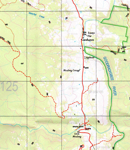
Courabyra 1-25,000 NSW Topographic Map
$16.95 – $31.95
Description:
8526-4-S Print on Demand
Courabyra 1-25,000 Scale NSW Topographical Map is used for Walking, 4WD, Fishing, Camping, Motorcycle, both On and Off Road, Gold Prospecting and for those simply going for a family weekend drive.
Topographical maps show not only Contours of the Terrain but also Walking Tracks, Sealed and Unsealed Roads, Rivers, Creeks, Lakes, Historical Point of Interest, Old Mine Sites and National and State Park areas.
 We can Now LAMINATE and fold your NSW 1-25,000 Topographical map for $12.00. Just click on the image and Add to the Trolley
This map includes the following localities: Ash Gully Ash Creek Andrews Gully Back Creek Back Creek Left Branch Bago State Forest Baileys Gully Bobtail Gully Black Gully Black Creek Boxes Gully Broadhursts Creek Buchanans Creek Buchanans Gully Buddong Falls Buddong Range Buddong Ridge Bull and Damper Creek Charcoal Gully Christians Gully Clarkes Gully Clear Creek Cockneys Creek Cockneys Spur Coffee Pot Corduroy Gully Courabyra Dallans Gully Eurabbie Gully Foxes Creek Frikes Creek Gap Gully Goldies Gully Gordons Gully Gormans Gully Granite Granite Mountain Hammonds Gully Hardys Mill Hardys Sugarloaf Harrisons Gully Howards Gully Hussels Gully Hyde Kellys Gully Keoghs Ridge Clarks Gully Corduroy Creek Dallans Creek Eurabbie Creek Gap Creek Gordons Creek Gormans Creek Horse Creek Keoghs Range King Lagoon Gully Lindsays Creek Lyne Park Mackays Gully Mccabes Creek Mccredies Gully Mcgregors Gully Main Range Mettys Gully Middle Ridge Millers Gully Mitchell Gully Mount Ash Creek Mullins Gully Nutt Gully Paddys River Dam Parsons Gully Patrick Gully Pells Gully Permanent Creek Perrots Flat Pleasant Gully Plot Creek Plot Gully Pound Ridge Powers Creek Quartzville Reeds Creek Reef Creek Reids Creek Right Branch Sandy Creek Sandy Gully Scotchmans Creek Scotchmans Gully Shay Creek Shay Gully Sheepyard Creek Shores Gully Smalls Gully Sparkes Creek Sparkes Gully Spencers Creek Steep Gully Stockmans Creek Stockmans Gully Storm Lookout The Storm Lookout Sugarloaf Tarcutta Swamp The Island Tomneys Plain Tumbarumba Tumbarumba Golf Course Weir Creek Weir Gully White Horse Creek Wickhams Gully Wild Mares Creek Wild Mares Gully Willigobung Swamp Doctors Creek Dog Creek Doughtys Gully Duffers Gully Doughty Gully Burnt Gully Burra Ridge Bago Flora Reserve Paddys River Flora Reserve Mansfield Gully Willigobung Buddong Horse Gully
| Scale: | 1:25000 |
| Latitude Range: | 35 37.5 S – 35 45.0 S |
| Longitude Range: | 148 00.0 E – 148 15.0 E |
| Approx Print Size: | 0.56m X 1.11m |
| Projection: | Transverse Mercator |


