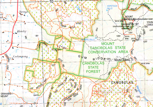
Cudal 1-50000 NSW Topographic Map
$16.95 – $31.95
Description:
Cudal 8631-S 1-50,000 scale NSW Topographical map is used for Walking, 4WD, Fishing, Camping, Motorcycle, both On and Off Road, Gold Prospecting and for those simply going for a family weekend drive.
Topographical maps show not only Contours of the Terrain but also Walking Tracks, Sealed and Unsealed Roads, Rivers, Creeks, Lakes, Historical Point of Interest, Old Mine Sites and National and State Park areas.
 We can Now LAMINATE and fold your map for $12.00. Just click on the image and add to the Trolley
NOW AVAILABLE PRINT ON DEMAND
Locations within this Map
Brookley Carinya Valley View Avalon Lorraine Cargo Cudal Back Creek Avonel Mount Alice Bald Hill Barragan Barrajin Barton Barton Nature Reserve Battye Browns Springs Black Rock Range Black Rock Ridge Black Mountain Black Flat Creek Boree Boree Cabonne Boree Creek Boreenoir Bourimbla Creek Bowan Bowan Park Bowen Park Bowan Creek Bridge Creek Cadia Cemetery Cadia Canomodine Canomodine Creek Canongle Creek Cargo Creek Cargo Gully Cargo Public School Cargo Well Mount Canobolas Canobolas Clarendon Cobblers Creek Codeys Mount Coffee Hill Creek Mount Cole Columbine Columbine Mountain Cranbury Cudal Cemetery Cudal Post Office Cudal Public School Deep Creek Edinburgh Federal Falls Fern Creek Four Mile Creek Glenwood State Forest Goimbla Grahams Mount Grove Creek Gum Creek Gum Ridge Johnstons Pinnacle Cadia General Cemetery Town of Cargo Caves Creek Village of Cudal Deep Gully Goonigaldooringang Creek Grahams Mountain Gum Flat Creek Jumpers Hill Lapstone Hill Lapstone Range Lees Mount Lees Mountain Lidster Hill Limestone Valley Longs Corner Lockwood Long Corner Malachis Hill Mandagery Mandagery Mountains Mandagery Ridge Mandagery State Forest Margaret Creek Mogong Mogong Creek Molong Sugarloaf Mount Canobolas Park Moura Murga Murga Public Shcool Nangar Nangar National Park Nangar Range Nangar Ridge Nangar State Forest Native Dog Creek Nyrang Oaky or Bourimbla Creek Paling Yard Creek Paling Yards Creek Paling Yards Public School Panuara Panuara Public School Panuara Rivulet Pinnacle Creek Police Dam Poplar Gully Quarry Creek Reedy Creek Regans Creek Rennys Gully Saltwater Creek Salt Water Creek Soldiers Creek Splitstuff Creek Spring Creek Sugarloaf Creek Swallow Creek Terarra Terarra Creek Terarra or Trowel Creek The Black Mount The Pinnacle Toms Waterholes Creek Toogong Toogong Village Of Toogong Cemetery Toogong Public School Towac Mount Towac Wallace Creek Warree Creek Watts Pinnacle Woolonbean Dam Diggers Creek Young Man Canobola Bulls Creek Bulls Gully Dingoer Burdett Canobolas State Forest Coolamatong Flora Reserve Gerybong Creek The Canobolas Dean Park Lidster Cheesemans Creek Nangar Mountains Cargo Village Green Borenore Penard Toogoong Oaky Creek Bowar Creek The Black Mountain Brinsley Avenel Mount Nangar Checkers Minoru
| Name: | Cudal |
| Publisher: | New South Wales Government |
| Scale: | 1:50000 |
| Latitude Range: | 33° 15.0′ S – 33° 30.0′ S |
| Longitude Range: | 148° 30.0′ E – 149° 0.0′ E |
| Datum: | GDA 94 |


