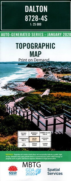
Dalton 1-25,000 NSW Topographic Map
Price range: $16.95 through $31.95
Description:
8728-4-S Print on Demand
Dalton 1-25,000 Scale NSW Topographical Map is used for Walking, 4WD, Fishing, Camping, Motorcycle, both On and Off Road, Gold Prospecting and for those simply going for a family weekend drive.
Now LAMINATE and fold your NSW 1-25,000 Topographical map for $12.00. Just click on the image and Add to the Trolley
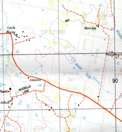
This map includes the following localities: Back Creek Basin Creek Benbengeno Creek Blakney Creek Black Gully Branch of Blakney Creek or Little Plains Creek Dalton Dalton Public School Dalton Tank Devils Elbow Felled Timber Creek Flacknell Creek Greendale Greendale Creek Handys Creek Hudson Park Jerrawa Creek Town of Dalton Kildare Creek Langs Creek Little Plains Creek Midgee Range Mistake Creek Oolong Creek Sams Creek Savages Creek Sheep Station Creek Ti-Tree Creek Water Gully The Water Gully Western Branch of Felled Timber Creek Dirt Hole Gully Dowlings Creek Dry Creek The Dry Creek Bunton Bunton Creek Broadway Kildare
| Scale: | 1:25000 |
| Latitude Range: | 34 37.5 S – 34 45.0 S |
| Longitude Range: | 149 00.0 E – 149 15.0 E |
| Approx Print Size: | 0.56m X 1.11m |
| Projection: |
Transverse Mercator |