Fairholme 1-50000 NSW Topographic Map
$16.95 – $31.95
Description:
Print on Demand
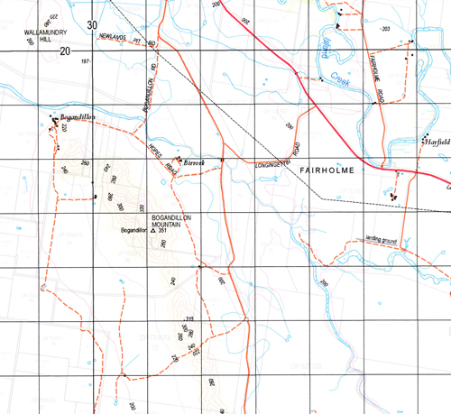
Fairholme 8331-S 1-50,000 scale NSW Topographical map is used for Walking, 4WD, Fishing, Camping, Motorcycle, both On and Off Road, Gold Prospecting and for those simply going for a family weekend drive.
Topographical maps show not only Contours of the Terrain but also Walking Tracks, Sealed and Unsealed Roads, Rivers, Creeks, Lakes, Historical Point of Interest, Old Mine Sites and National and State Park areas.
 We can Now LAMINATE and fold your map for $12.00. Just click on the image and add to the Trolley
NOW AVAILABLE PRINT ON DEMAND
Locations within this Map
Somerset Marmora Khumbir Bogandillon The Island Werenta Glen Eden Burragong Ilgindrie Park Birrork Moonbi Fairholme Strangleland Kookaburragong Loch Maree Carlowrie Lachlan Dale The Ranch Laurel Hills Kanandah Evergreen Kerray Nerokewa Glencoe Yarran Park Burratoo Laurieston Ederney Hill Rosewood Wilga Hill Glen Rock Star Sight Northmyee Ascot Bellview Manna Station Wamboola Ascot Vale Merrylands Manna Park Kinta Bizi Acres Enfield Park Myrtlevale Kennedia Euglo Raheen Minimanna Dungarvan Alawa Cooinooi Belle Forest Moora Moora Yarranlea Banar Banar Tank Bena Blue Range Blue Ridge Bogandillon Creek Bogandillon Mountain Bogandillon or Manna Creek Bogandillon Swamp Cadow Cadow Channel Cadow No 2 Channel Cadow State Forest Cadow Swamp Cookaburragong Cookaburragong Tank Crown Camp Currah Darby Darbys Ridge Euglo South Euglo South National Forest Euglo South State Forest Euglo Tank Humbug Creek Ilgindrie Ina Island Creek Jemalong Channel Kerribrew Ridge Darbeys Darbeys Ranges Dunns Swamp Euglo Dam Euglo or Humbug Creek Gum Cowal Katerbro Range or Kerribrew Range Lake View Lower Bena Dam Manna Manna Creek Manna Mountain Manna or Yeo Yeo Creek Manna State Forest Merrimarotherie Milbee Moonbia Muloutherie Creek Nerang Cowal Nerang Cowal National Forest Nerang Cowal State Forest Ridley Round Swamp Steel Steel Lookout Steels Lookout Ulgutherie Creek Warroo Channel Warroo No 2 Channel Weelah Weelah State Forest The Weelah State Forest Wilga Lagoon Yarnel Dog Kennel Hill Black Fella Hole Black Fella Rock Gum Cowal Swamp Banar Swamp Banar Lake Mount Wollomundry Yeo Yeo Creek Eagle Creek Euglo Creek Ellerslie Stony Peak
| Name: | Fairholme |
| Publisher: | New South Wales Government |
| Scale: | 1:50000 |
| Latitude Range: | 33° 15.0′ S – 33° 30.0′ S |
| Longitude Range: | 147° 0.0′ E – 147° 30.0′ E |
| Datum: | GDA 94 |


