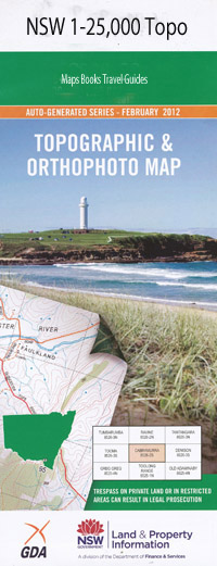
Grafton 1-25,000 NSW Topographic Map
$16.95 – $31.95
Description:
9438-1-S Print on Demand
Murragang Caramana Yorong Chambigne Rushforth Grafton Waterview Heights Apollo 11 Park Alumy Creek Balwarra Heights Battery Gully Bawden Bridge Bellevue Heights Bishop Druitt Park Bom Bom State Forest Buchans Gully Caines Creek Carrs Creek Carrs Island Carrs Peninsula Cattle Creek Chain of Ponds Christopher Creek Clarence Valley Public School Conroy Creek Cowans Creek Cowans Pond Cowans Pond Reserve Crockers Waterholes Crowther Island Deep Gully Durrington Park Earl Page Memorial Park Eatonsville Edgecombe Eldon Creek Elizabeth Island Park Elland First Falls Fisher Park Flaggy Creek General Douglas Macarthur Park Gillwinga Public School Gordon Wingfield Park Grafton Cemetery Grafton City Railway Station Grafton Gaol Grafton High School Grafton Post Office Grafton Public School Grafton Racecourse Grafton Railway Station Grafton South High School Grafton South Public School Grafton Technical College Great Marlow Hawthorne Rodeo Park Jacaranda Jacaranda Park Junction Hill Caringa School Carrs Creek Junction Chainey Waterholes Chambigne Gully Christophers Creek Cowan Creek Deep Creek First Gully Flaggy Gully Grafton West Public School Koolkhan Creek Little Swan Creek Mckittrick Park Market Square Mattiers Creek Munns Creek Musk Valley Creek Mylneford North Park The Parade Ground Picnic Creek Ramornie Rodeo Ground Rushforth Park Rushforth Park Soccer Fields Rushforth Road Playing Fields Ryans Gully Saltwater Creek Sandhills Creek See Park Silver Jubilee Park Southampton South Crockers Waterholes South Grafton South Grafton Aerodrome South Grafton High School South Grafton Public School South Grafton Racecourse Reserve South Grafton Railway Station Southions Creek Southians Creek Strontian Park Susan Island Nature Reserve Susan Island Swan Creek Swan Creek Public School The Battery Creek The Junction Turville Urara Volkers Park Washpen Creek Washpool Creek Waterview Westlawn Public School Westward Park West Ward Park Dry Creek Jaycee Park Alex Bell Reserve Salty Seller Reserve Elizabeth Island Carrs Peninsular Mckenzie Park Cedar Park Derek Palmer Place Induna Reserve Meillon Park Pioneer Park Elsie Crisp Park Grafton Girl Guide Place Grafton Jaycees Park Jabour Park Frank Mcguren Field Lane Boulevard Ramornie Works Alumny Creek Jackys Creek O.B.X. Creek
| Name: | Grafton |
| Publisher: | New South Wales Government |
| Scale: | 1:25000 |
| Latitude Range: | 29° 37.5′ S – 29° 45.0′ S |
| Longitude Range: | 152° 45.0′ E – 153° 0.0′ E |
| Datum: | GDA 94 |
| Approx Print Size: | 0.56m X 1.11m |

