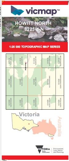
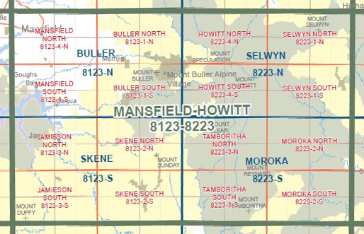
HOWITT NORTH 1-25,000 Vicmap Topo Map 8223-4-N
Price range: $14.00 through $26.00
Description:
HOWITT NORTH 1-25,000 Vicmap Topographic Map 82234N Now Print On Demand is used for Walking, 4WD, Fishing, Camping, Motorcycle, both On and Off Road, Gold Prospecting and for those simply going for a family weekend drive.
This is a new series of 1-25,000 scale maps, all of Victoria is now covered by these maps, including maps over the South Australian and NSW Borders.
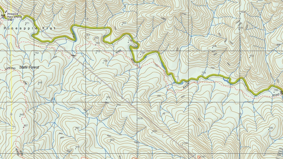
Topographical maps show not only Contours of the Terrain but Walking Tracks, Sealed and Unsealed Roads, Rivers, Creeks, Lakes, Historical Points of Interest, Old Mine Sites mbtg and National and State Park areas.
Also now available printed on Plastic Waterproof Paper Folded
Main Features of this map includes:
Part of the Alpine Walking Track
The edge of Mount Speculation, THE MONUMENT, MONUMENT Saddle, Clear Hills, Pineapple Flat Camping Area, Burnt Top, Razorback, Little Cobbler, King Hut Camping Area, Stanleys Name Gap, The Staircase, Mount Cobbler, Long Jack Creek Natural Catchment Area, Lake Cobbler, MOUNT KOONIKA, Catherine Saddle, Mount Stirling, Mount Despair, Razor – Viking Wilderness Zone, The Razor, The Viking, Viking South
You may also like…
-
Snowy Mountains Central Adventure Map Rooftop
Price range: $12.95 through $25.00Select options This product has multiple variants. The options may be chosen on the product page -
Selwyn 1-50,000 Vicmap
Price range: $12.00 through $24.00Select options This product has multiple variants. The options may be chosen on the product page -
HOWITT SOUTH 1-25,000 Vicmap Topo Map 8223-4-S
Price range: $14.00 through $26.00Select options This product has multiple variants. The options may be chosen on the product page -
Buller North 1-25,000 Vicmap Topographic Map 8123-1-N
Price range: $14.00 through $26.00Select options This product has multiple variants. The options may be chosen on the product page -
SELWYN NORTH 1-25,000 Vicmap Topo Map 8223-1-N
Price range: $14.00 through $26.00Select options This product has multiple variants. The options may be chosen on the product page