
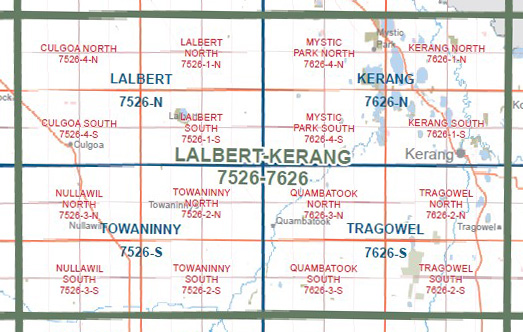
KERANG SOUTH 1-25,000 Vicmap Topo Map 7626-1-S
Price range: $14.00 through $26.00
Description:
KERANG SOUTH 1-25,000 Vicmap Topographic Map 76261S Now Print On Demand is used for Walking, 4WD, Fishing, Camping, Motorcycle, both On and Off Road, Gold Prospecting and for those simply going for a family weekend drive.
This is a new series of 1-25,000 scale maps, all of Victoria is now covered by these maps, including maps over the South Australian and NSW Borders.
Topographical maps show not only Contours of the Terrain but Walking Tracks, Sealed and Unsealed Roads, Rivers, Creeks, Lakes, Historical Points of Interest, Old Mine Sites, mbtg and National and State Park areas.
Main Features of this map includes:
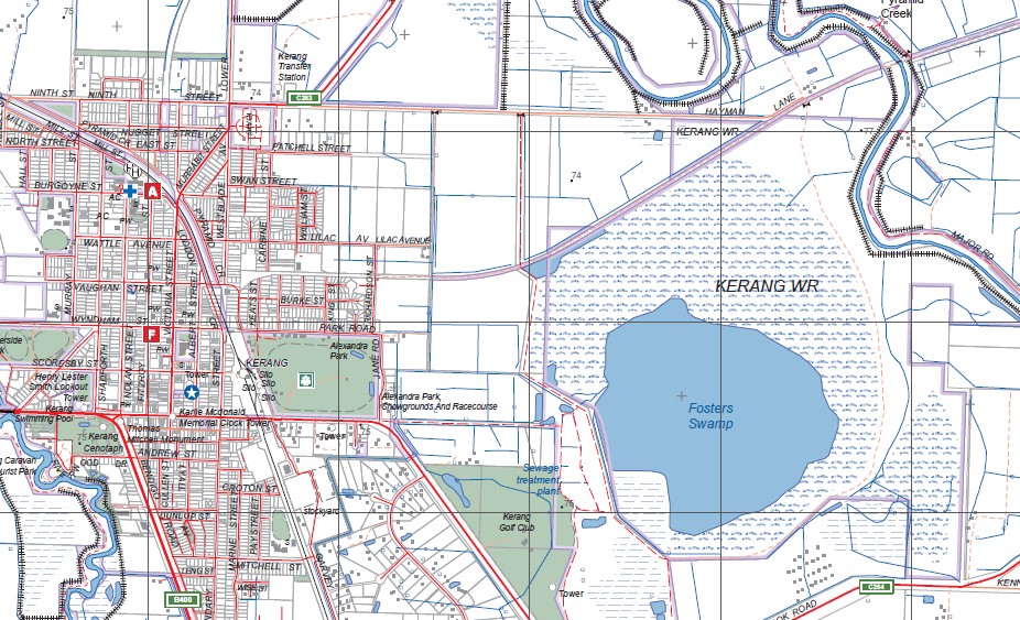
Covers the Old Series 1-25,000 Kerang South
Kerang, Lake Cullen (salt), Cranes Lake (salt), Third Lake, part of Dartagook WR, Capels Crossing SSR, Westblades Swamp, Plumptons WR, Reedy Lake, Middle Lake, Salt Lake, Duck Lake WR, edge of Lake Bael Bael, mbtg, Lake Elizabeth, part of Kerang RP, Fosters Swamp, part of Pyramid Creek, Pelican Lake, Wandella NCR, Gannawarra Solar Farm, Lake Wandella.
You may also like…
-
Cohuna Echuca Gunbower Map Hayman
Price range: $12.95 through $25.00Select options This product has multiple variants. The options may be chosen on the product page -
Kerang 1-50,000 Vicmap
Price range: $12.00 through $24.00Select options This product has multiple variants. The options may be chosen on the product page -
KERANG NORTH 1-25,000 Vicmap Topo Map 7626-1-N
Price range: $14.00 through $26.00Select options This product has multiple variants. The options may be chosen on the product page