


Kinglake Special North and South 1-25,000 Vicmap Topographic Map Set
$26.00 – $50.00
Description:
Kinglake Special North and South 1-25,000 Vicmap Topographic Map Set 2 maps at 1-25,000 covering the Kinglake National Park
Now Print On Demand is used for Walking, 4WD, Fishing, Camping, Motorcycle, both On and Off Road, Gold Prospecting and for those simply going for a family weekend drive.
This is a new series of 1-25,000 scale maps, all of Victoria is now covered by these maps, including maps over the South Australian and NSW Borders.
Topographical maps show not only Contours of the Terrain but Walking Tracks, Sealed and Unsealed Roads, Rivers, Creeks, Lakes, Historical Points of Interest, Old Mine Sites mbtg and National and State Park areas.
Now available printed on Waterproof Plastic Paper Folded
Main Features of this map set includes:
Northern Section of Kinglake National Park
PHEASANT CREEK BR, Mount Disappointment Inset Map.
Southern Section of Kinglake National Park
Kinglake, St Andrews, Arthurs Creek, Cottles Bridge, Smiths Gully, Dixons Creek, Mitton Bridge, Strathewan, Mount Sugarloaf, Steeles Creek
Below is the link to the Kinglake Special North which completes the Kinglake National Park at 1-25,000
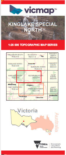 Kinglake Special North
 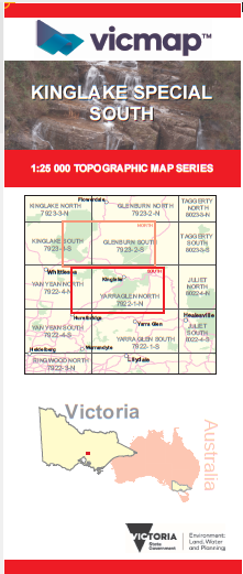 Kinglake Special South