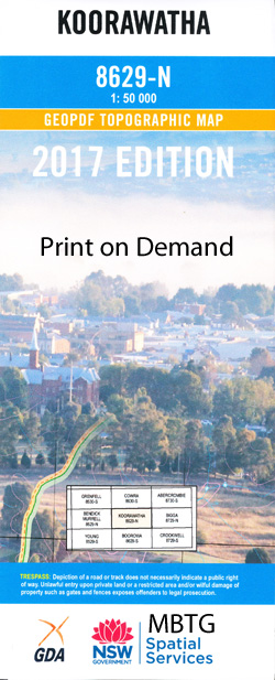
Koorawatha 1-50000 NSW Topographic Map
$16.95 – $31.95
Description:
Koorawatha 8629-N 1-50,000 scale NSW Topographical map is used for Walking, 4WD, Fishing, Camping, Motorcycle, both On and Off Road, Gold Prospecting and for those simply going for a family weekend drive.
Topographical maps show not only Contours of the Terrain but also Walking Tracks, Sealed and Unsealed Roads, Rivers, Creeks, Lakes, Historical Point of Interest, Old Mine Sites and National and State Park areas.
 We can Now LAMINATE and fold your map for $12.00. Just click on the image and add to the Trolley
NOW AVAILABLE PRINT ON DEMAND
Locations within this Map
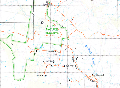
Oakleigh Roslea Alta Villa Warrangong Cabana Meadowbank Pine Hill Rockdale Rosehill Cocomingla Lawling Vale Bennet Springs Ceweroo Riversteen Maryamma Alston Bon-A-View Kooradale Smesto Woodleigh Yeronga Clarence Gap Maroo Balla Downs Cucumgilliga Grasmere Jennincona Kooringle Silentdale Kilkee Stud Banoon Westwood Cucumgilliga South Kylie Park Glendon Spring Creek Box Range Stony Ridge Crowther Hillside Kia-Ora Tenahbi Lodgedale Vine Lodge Riverview Winderadene Karoopa Cloverdeene Hillview Willow Glen Barrelli Caringa Ballymena Tatong Glenavon Taroona Bonanza Newhaven Park Strathfield Sunnyside Clonalton Glenview Woolpack Karlee Kenyu Brooklyn Windermere Glen Allen Colo Gungahleen Yundoo Glenbrook Ingleside Channel Little Forest Forest Creek Sunnyridge Templimore Rowena Wirrana Dranoel Spring Valley Dorroughby Tyrone Omach Eurimba Forest Lodge Ballyhooley Koorawatha Back Creek Alton Bakers Creek Bald Hill Bales Creek Bang Bang Bang Bang Creek Bendick Bendick Creek Bendick Murrell Creek Bendick Murrell Gap Black Springs The Black Springs Blacketts Creek Bolter Creek Branch of Opening Creek Breakfast Creek Bules Creek Church Creek Coppermine Hill Corcorans Creek Crowther Creek Crowther Gap Crowther Railway Station Cucum Cucum Creek Cucumgillica Public School Dananbilla Dananbilla Nature Reserve Darling Mount Darling Dead Mans Gully Deep Creek Deep Gully Gap Creek Godfreys Creek Graham Grahams Creek Happy Jacks Creek Harrys Creek Hovell Hovells Creek Hunter Ridge Illunie Illunie Creek Illunie Range Jemersons Creek Kangaroo Creek Kember Cat Creek Cocomingla Creek The Coppermine Crowther Platform The Deep Creek Dwyers Springs Gunning Creek Mount Hunter Range Jemersons Gully Jourdans Creek Jourdens Creek Kilcow Creek Kinghorne Creek Koorawatha Creek Koorawatha Cemetery Koorawatha Public School Koorawatha Railway Station Koorowatha Koorowatha Public School Kurrajong Creek Macneil Creek Maryamma Creek Monteagle Morongla Morongla Creek Mount Morris Mountain Flat Creek Mount Collins Mount Darling Range Murringo Murringo Creek Murringo Flats Murringo North Narrallen Narrallen Creek Neila Neila Creek Newham Newhams Creek Numby Oaky Creek Opening Creek Pine Creek Pipe Clay Mountain Pound Creek Prings Gap Prossers Crossing Quigleys Gully Reedy Creek Reedy Flat Creek Reynolds Mount Reynolds Right Hand Creek Rock Hole Creek Rossi Rough Hill The Rough Hill Sandy Creek Sawyers Creek Slatterys Hill Spring Arm Stony Creek Sullivans Creek Sullivans Gully Sullivans Springs Tarrants Gap Top Creek Trengove Park Wallaroo Creek Warrangong Creek Warrangong Hills Washpan Creek Wattle Flat Creek Wild Horse Camp Wommerah Creek Woolpack Creek Wyangala Yambarri Creek Dog Trap Creek Dog Trap Hill Dry Creek Douglas Spring Creek The Dry Creek Koorawatha Nature Reserve Illunie Nature Reserve Meadow Mountain Mount Baker Spring Vale Phils Creek Mount Hunter Stoney Creek
| Name: | Koorawatha |
| Publisher: | New South Wales Government |
| Scale: | 1:50000 |
| Latitude Range: | 34° 0.0′ S – 34° 15.0′ S |
| Longitude Range: | 148° 30.0′ E – 149° 0.0′ E |
| Datum: | GDA 94 |


