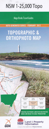
Lithgow 1-25,000 NSW Topographic Map
$16.95 – $31.95
Description:
8931-3-S Now Print on Demand
Eurondella Thompsons Creek Fairview Pine Crest The Nook Kaimona Barton Park Clear View Banyula Bonny Hills Roma Mandala Dunderra Iffley Eather Wewurka Olivetta Kubba Kundi Summerhill Lithgow Wallerawang Adams Creek Bald Black Springs Creek Black Springs Hill Blackbutt Gully Blackbutt Creek Bowenfels Bowenfels Railway Station Bracey Browns Gap Browns Swamp Clarence Mount Clarence Clwydd Cooerwull Cooerwull Public School Cooerwull Railway Station Elizabeth Vale Farmers Creek Good Luck Hollow Happy Valley Springs Heedys Gully Hermitage Honeysuckle Flat Mount Horne Ida Falls Creek Irondale Creek Kerosene Vale Clarence Railway Station Coebwull Coerwull Brook Cooerwull Brook Crancemore Edgecombe Railway Loop Eskbank Railway Station The Gap Gleeson Creek Mount Horn Lidsdale Lidsdale State Forest Lithgow Cemetery Lithgow High School Lithgow Post Office Lithgow Public School Lithgow Railway Station Lithgow Spur Lithgow Technical College Lithgow Valley Creek Lithgow Valley Gully Lithgow Valley Reserve Lithgow Zig Zag Lords Creek Lords Gully Magpie Hollow Marangaroo Marangaroo Creek Marangaroo Public School Marrangaroo Public School Marangaroo Railway Station Marrangaroo Marrangaroo Creek Marrangaroo Ridge Middle River Middle River Range Newnes State Forest Paddys Creek Paddys River Mount Piper Rydal Rydal Cemetery Rydal Public School Rydal Railway Station Village of Rydal Sawyers Swamp Scenic Hill Mount Sinai Slavens Creek Slavens Gully Solitary Creek State Mine Creek State Mine Gully The Great Zig Zag Mount Walker Wallerawang Post Office Wallerawang Public School Wallerawang Railway Station Wang Watercress Creek Watercress Gully Winters Creek Wolgan River Zig Zag Public School Diwana Bungleboori Lake Wallace Snow Gum Flora Reserve Vale of Clwydd Cobar Park Littleton South Littleton Corney Town Morts Estate Hermitage Flat Pottery Estate Doctors Gap McKellars Park Springvale Oaky Park Sheedys Gully Marrangaroo National Park Church Pres Colliery Lidsdale Forest Irondale Mount Bald Bowenfels Station Newnes Junction Blue Mountains
Product: .Lamination of NSW Topographic Map FOLDED $12.00
| Name: | Lithgow |
| Publisher: | New South Wales Government |
| Scale: | 1:25000 |
| Latitude Range: | 33° 22.5′ S – 33° 30.0′ S |
| Longitude Range: | 150° 0.0′ E – 150° 15.0′ E |
| Datum: | GDA 94 |
| Approx Print Size: | 0.56m X 1.11m |

